|
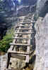
Just
below the ledges is Hi-Cannon's ladder. Although Muffin is usually
very good at finding alternative routes around ladders, I decided
to carry her down this time. Not wanting to take off my crampons
just to put them on again at the bottom, I had to be careful not
to trip, so I descended face forward, holding onto Muffin with
one arm and the ladder with the other.
Finally,
we reached the Dodge Cutoff, which wasn't quite so well-traveled.
It was also more snowy than icy, so I switched to my snowshoes
to avoid postholing in the decaying soft surface of the snow.
At
the shores of Lonesome Lake, it was a quick trip over to the hut.
The snow still covered most of the timber puncheons on the trail,
so it was actually faster-going than in the spring or early summer
when the trail tends to be quite muddy.
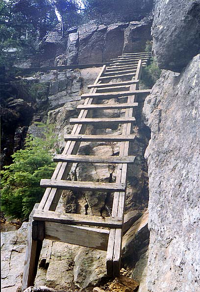
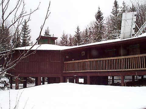
At
the hut,
we sat in the dining room for a short rest, talked to the caretaker,
and bought a t-shirt. Now that it was open on a self-service basis
all winter, the hut had been renovated. New shingles and a boarded-up
underside gave it a brighter look, and improved the insulation.
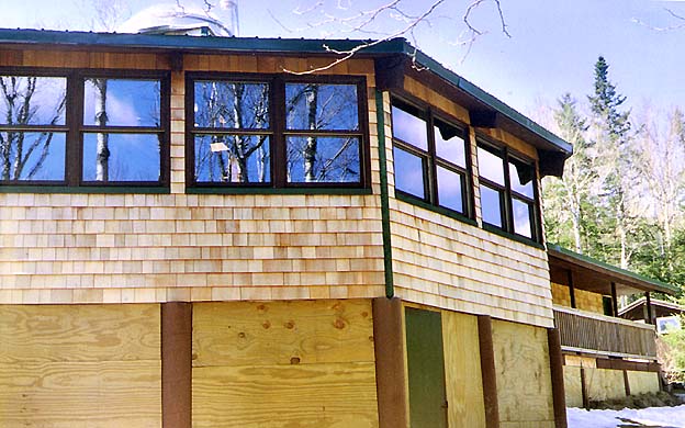
Before
heading
down, we stopped by the shores of the lake to admire the views
of Franconia Ridge. The weather had certainly changed for the
better, although Mt Lafayette was still in the clouds.
Descending
the Lonesome Lake Trail, we met a couple of people on their way
up. Without snowshoes or crampons, they were struggling to stay
on their feet. It was a tough call, but I kept my snowshoes on
most of the way down. The trail was pretty rocky, but the patches
of ice were just too numerous not to use some sort of protection.
I finally removed them after making the sharp turn left at the
bottom of the stairs where the trail makes its first major switchback.
By
the time we reached the Lafayette Place campground, all patches
of snow and ice had disappeared. From there, I had planned on
taking the Pemi Trail back to the Tramway parking area. Unfortunately,
the Pemi Trail was extremely wet, muddy, and impossible to follow.
I finally gave up and we bushwhacked the short distance back to
the less interesting, but drier bike path, which took us to the
south end of Profile Lake. From there, we just followed along
the edge of the highway back to the car. |
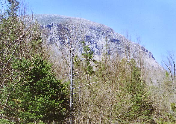
The
ladder on the Hi-Cannon Trail. Although Muffin is usually very
good at finding alternative routes around ladders, I had to carry
her down this time. |
|