|
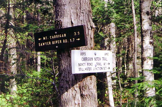
Just
past Carrigain Brook Rd, we reached the junction with the Carrigain
Notch Trail. This trail branches off to the north to pass through
the notch between Mts Carrigain and Lowell, then turns south to
meet up with the Desolation Trail which ascends the steep north
slope of Mt Carrigain.
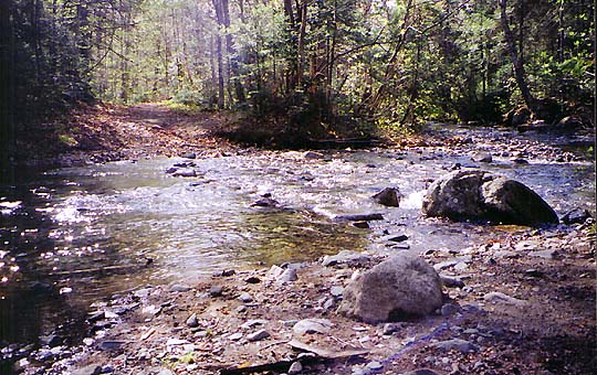
We
stopped for a quick snack, then continued up the trail where we
soon reached a crossing of Carrigain Brook. The water level wasn't
very high and we rock-hopped easily across to the other side.
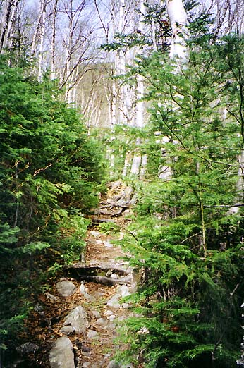
The
trail soon began to ascend more steeply, which was fine with me
as I was ready to start gaining some elevation. For a while, the
trail followed the course of the brook. Then, a couple of switchbacks
later, we turned onto a straight birch-lined section of the trail
that angled up the east side of steep Signal Ridge for about a
mile. This portion of the trail was bright and cheery, with occasional
glimpses down into Carrigain Notch.
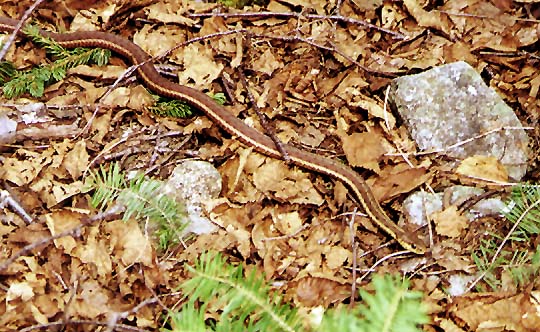
On
one large rock in the middle of the trail, we came across a garter
snake that had been sunning itself, but it quickly took off as
we approached.
Near
the top of the birch-lined section, the views really began to
open up. Then, the trail veered back into the woods and switchbacked
its way up the ridge as the trees got smaller and scrubbier.
At
a fairly level area that looked like it would have made a decent
campsite (assuming that water were available), we stopped for
a short rest and drink. After the last pitch, we finally attained
the ridge at a small clearing with a cairn which could be mistaken
for the summit by those without a map and guidebook.
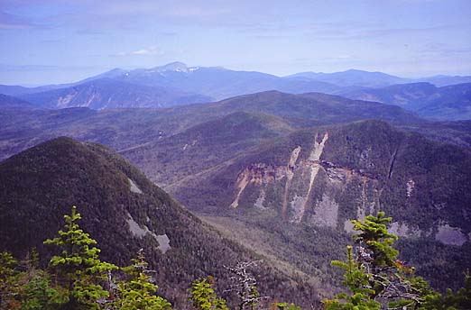
Just
off the trail was an outlook with great views of Carrigain Notch
and the scarred cliffs of Mt Lowell. In the distance were Crawford
Notch and the Webster Cliffs, and behind them, Mt Washington and
the Presidential Range. |