|
As
I was leaving Mt Hight, the nice blue skies were beginning to
fade, as clouds had begun to roll in from the south. The trail
plunged steeply at first, then moderated, eventually reaching
Zeta Pass, the low point between Mt Hight and South Carter. I
had been drinking a lot of water, so I stopped in the Pass to
filter some water from a little stream and refill my water bottles.
It was nice and cold.
By
now, the clouds were getting much thicker, and my tooth was acting
up again, so I was beginning to consider not going on all the
way to the Imp Shelter, which was still 5 miles and 3 peaks off.
From Zeta Pass, I could make an exit via the Carter Dome and 19-Mile
Brook Trails if necessary, but I decided to go on for now, at
least to the summit of nearby South Carter.
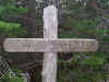
The
hike up South Carter wasn’t excessively steep, but the trail was
in bad shape with a number of downed trees and eroded areas. After
about 45 minutes, I reached the treed summit. Unlike the impossible
to find Wildcat peaks, South Carter had a weatherworn summit sign
to mark the spot.
While
still considering whether to go on to the Imp Shelter or turn
around and go back down through Zeta Pass and the Carter Dome/19-Mile
Brook Trails, another hiker approached from the north. He inquired
about the trails to the south and told me a bit about the trails
he had hiked up. My tooth was still acting up and the weather
was definitely getting cloudier, so I decided to turn around and
walk with him, rather than risk a wet night in a possibly full
shelter with a serious toothache and a limited supply of painkillers.
(As it turned out, my tooth did get much worse later on, so I
definitely would have had a rough night sleeping at the shelter
without stronger painkillers.)
We
hiked down to Zeta Pass in a half-hour, stopped for a quick water
break, then continued down the Carter Dome Trail, which headed
somewhat steeply down toward 19-Mile Brook, about 2 miles away.
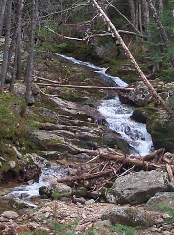
About halfway down this stretch, we reached a tributary of 19-Mile
Brook, and the rest of the way down was in the company of rushing
waters.
The
guy I had met had just finished a Masters Degree and was in the
process of looking for a job teaching English. He was thinking
about working somewhere near or in the White Mountains so he could
be closer to hiking. He currently lived in Dover, New Hampshire,
which is near Portsmouth.
We
soon reached the 19-Mile Brook Trail, which left another 2-mile
stretch to Rt 16 at a point about 3 miles north of Pinkham Notch.
After a short distance, I stopped to rest, eat a snack, and take
a drink while he continued on. As I rested, I began to feel a
few drops of rain.
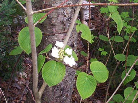
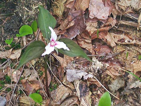
The
ground along the brook and trail was covered with flowers and
flowering bushes, such as purple trillium, painted trillium, and
hobblebush.
I
finally reached the road, but had to get back to my car, which
was still almost 10 miles north in Gorham. Since the 19-Mile Brook
Trail met Rt 16 basically in the middle of nowhere, I had to hitchhike
to Gorham. After walking about a mile or so up the road, and after
dozens of cars passed me by, someone finally stopped. It turned
out that he was another hiker, who had been up skiing in Tuckerman
Ravine on Mt Washington. He said he had been in similar circumstances
so was glad to give me a ride. He ended up taking me all the way
back to my car.
By
this time, my tooth was really hurting. I stopped at McDonald’s
in Gorham to get supper, took several ibuprofen, then drove back
to Pinkham Notch to look for a Carter Notch t-shirt in the AMC
store. While I was at Pinkham Notch, someone reported a missing
hiker who had not come down from Mt Washington as expected, and
it looked like the AMC was going to call out a search and rescue
when I left.
My
tooth pain was off and on, and was seriously bad when on, so I
drove home as quickly as I could, stopping only in Lincoln to
pick up a couple of souvenirs, and at a couple of rest areas.
Most of the trip back was in rain, but it had been a good trip
and I was already planning the next one. |
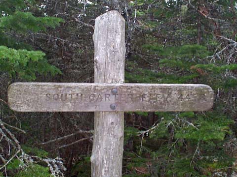
South Carter.
Unlike the impossible to find Wildcat peaks, viewless South Carter
had this weatherworn summit sign to mark the spot. |
|