|
Without a doubt, this was the wettest day for a hike I'd been on in a long time, if not ever. I'd been caught in a wild driving thunder and lightning storm in the dark on my way to Thirteen Falls in the Pemigewassett Wilderness after climbing Owl's Head, but at least the day had started out dry and the weather was warm. This time it was literally pouring and had been for several days. The rivers and brooks were all exceedingly swollen and dangerous, trails were soggy and laden with puddles, and several roads had been closed. On top of that, it was cold, unusually cold for a Memorial Day weekend with the temperatures hovering in the mid-thirties and a changeover to snow expected as night appoached.
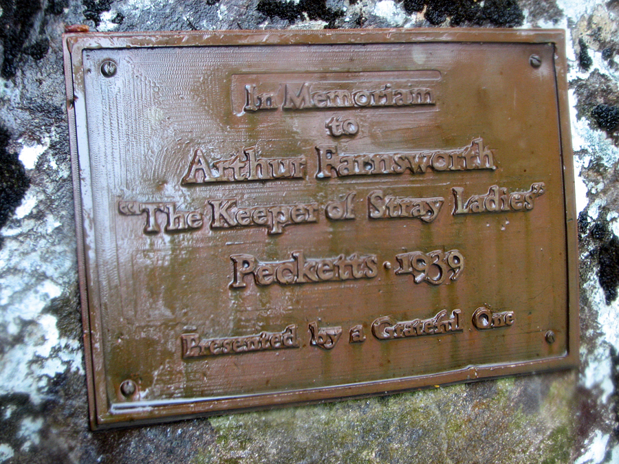
But at least I knew this, and was prepared. In fact, I chose this particular hike because of the weather; in nicer weather, I would have opted to climb one or more 4000-footers. But this hike has several fascinating draws: Bridal Veil Falls themselves, which would be spectacular with all the rain, a reputedly haunted former mining ghost town near the falls, and a mysterious cryptic plaque erected by Bette Davis in memory of her second husband, Arthur Farnsworth.
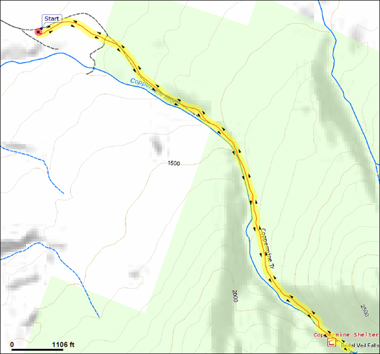
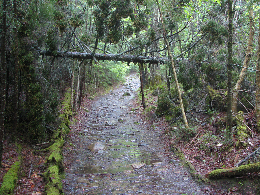
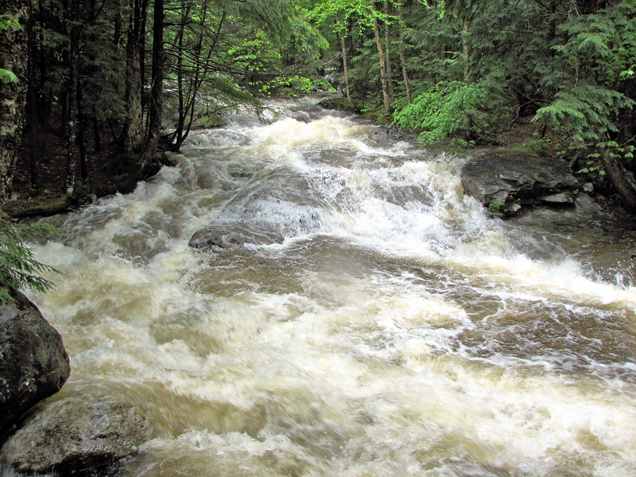
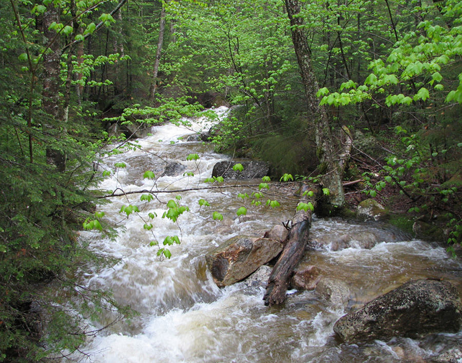
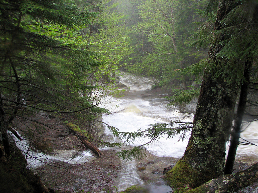
From the start, the trail was sodden and bounded by dripping branches. A cold fog pervaded the almost eerie woods. And since the trail never strayed far from Coppermine Brook, the roar of the rushing waters stayed with me throughout the hike. The brook itself wasn't actually visible until maybe a quarter mile into the hike. When I first came close to it to see for myself, the force of the churning waters was incredible, and I reflected that It woiuld likely have been deadly if one were to fall in.
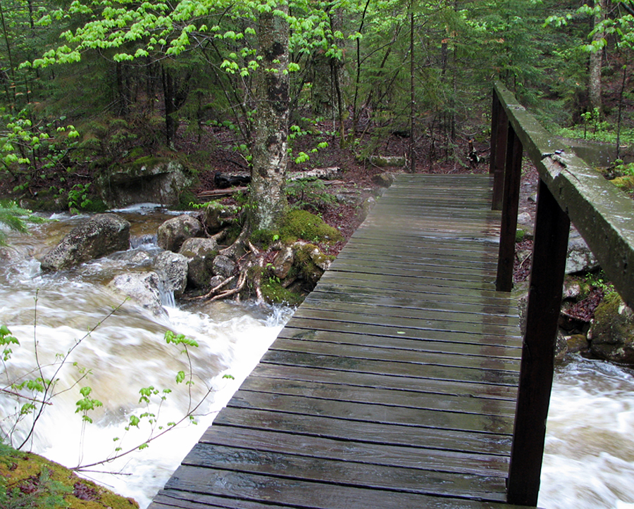
Although most of the trail was wide enough to avoid getting all the more soaked from brushing up against the foliage, the trail itself was often little more than a small brook. It wasn't long before even my Goretex boots had taken on a fair amount of bilge water. Still, the going was relatively easy and the grade almost inperceptible, so I made good time, and in about an hour I came to a small footbridge over Coppermine Brook that signaled that I was nearing my destination.
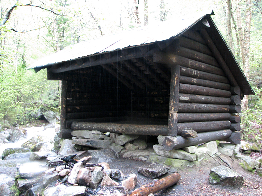
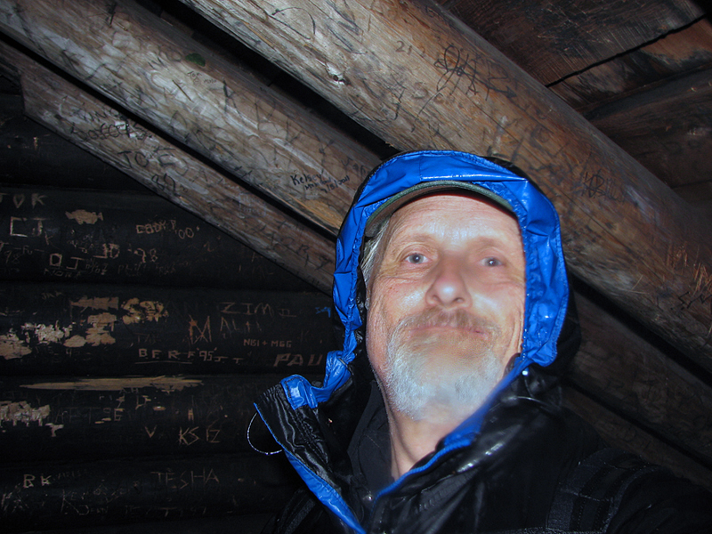
At the Coppermine Shelter, I ducked inside to get out of the rain for a a few moments; there, my lack of constantly moving about made me realize how wet and chilly I was beneath my rain jacket. Luckily, I had brought a complete change of clothes, so I took off my wet shirt and fleece and put on fresh dry ones. Then, after taking a couple of sodden pictures, I marched bravely back into the dampness and began searching for a way to get close to the falls which I could hear well enough but not yet see.
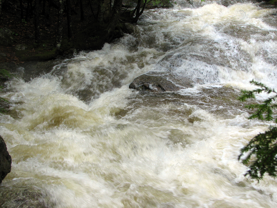
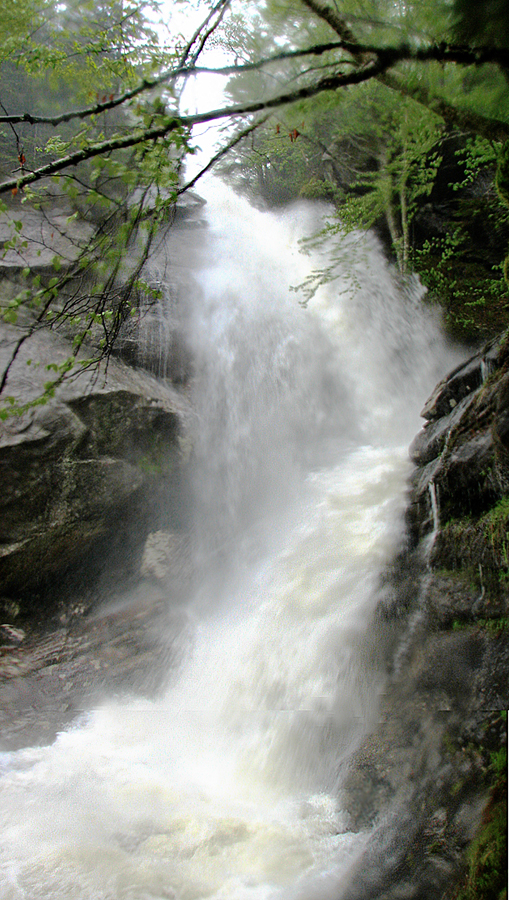
Never having been here before, I wasn't sure where the trail led beyond the shelter; the swollen brook had probably undoubtedly altered the landscape features. The only possible way to go was to pick my way carefully along a narrow rocky shelf between the brook and the cliffs. This route was littered with branches and at times, the brook waters lapped up onto the rocks I was trying to traverse. By holding onto whatever branches I could grab and taking careful steps in the slick parts, I made my way to a vantage point below the falls. It was definitely an impressive spectacle; the spray from the falls, the roar of the rushing waters, the crisp fresh wet earthy scent that pervaded the glen, the sense of aloneness in the melancholy cold mountain woods, and the sheer height of the falls themselves, all combined to heighten the experience.
Even though my foothold was somewhat precarious, it was tempting to want to stay there longer than I did, but I had a schedule to keep, and of course, I wouldn't stay dry forever in these conditions. As careful as I was picking my way up the slippery rocks, I was doubly so as I picked my way down them. A lost footing here would send me right into the unforgiving rushing waters of the brook. It was slow going, but I finally made my way back to the shelter where I picked up the trail again.
On the way back, based on a few clues gleaned from Haunted Hikes of New Hampshire by Marianne O'Connor, I managed to locate Bette Davis' "Keeper of Stray Ladies" plaque at spot where the riverbank widened into a sort of grove. It was here that she supposedly pretended to be lost in order to get Arthur Farnsworth, who worked at nearby Peckett's Inn in Sugar Hill, to come "rescue" her. He later became her second husband but died of under suspicious circumstances only three years later. |
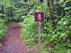
Coppermine Trailhead. The actual trailhead is about a 1/4 mile down Coppermine Road from the parking area. |
 |