|
This was Patches and my first hike in the White Mountains this year, due partly to COVID-19, my new part-time job, some health issues over the winter, and the distance of the drive from Cape Cod. We planned to climb Mt Jefferson as Jefferson Notch Rd had just opened for the season a few days earlier, and I wanted to complete the hike to the summit this time. In 2017, we had turned around in the middle of the Caps because I was not getting good traction with my hiking boots in the steep slab section after the first cap. This time, I was planning on wearing my approach shoes with sticky rubber soles.
We made the nearly four hour drive from home to the Sugarloaf I campground on Zealand Rd in Twin Mountain, where I set up camp, and then we drove to the AMC Highland Center. I needed to buy some new Nalgene waters bottles. I forgot one of my bottles at home, and I also wanted to cut some weight by not carrying my heavier Hydro Flask bottles.
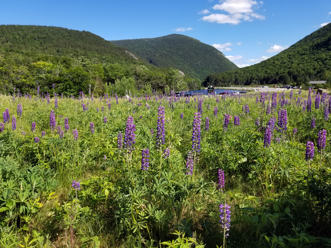
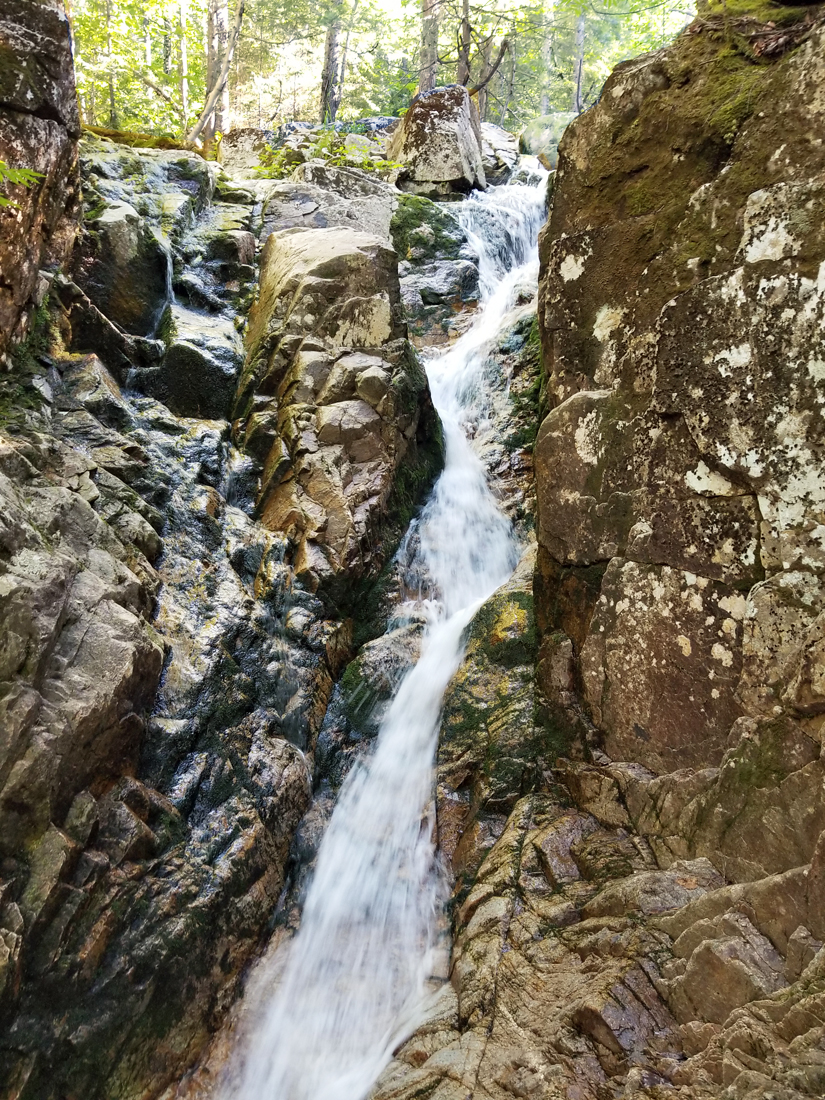
We also took a short hike up the Avalon Trail and Cascade Loop to Beecher and Pearl Falls, and then walked around the nature path in the field between the Highland Center and the train station. Afterward, we drove back to our campsite, had supper, and settled in for the night.
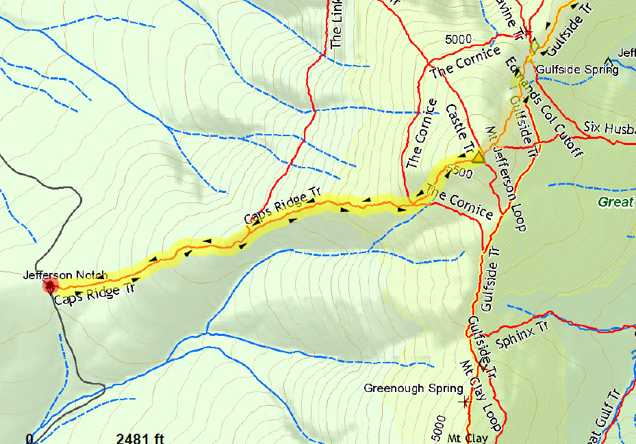
In the morning, after getting dressed, we got in the car for the drive to the Caps Ridge Trail. The NH DOT crews had done a good job grading Jefferson Notch Rd as it was pretty smooth with only a few rough spots. I ate a couple of breakfast bars in the car on the way there, but was saving Patches' food for a rest stop as she'd have been too excited to eat before getting out on the trail. There were already quite a few cars at the trailhead when we arrived around 9 AM, but there was still room for several more.
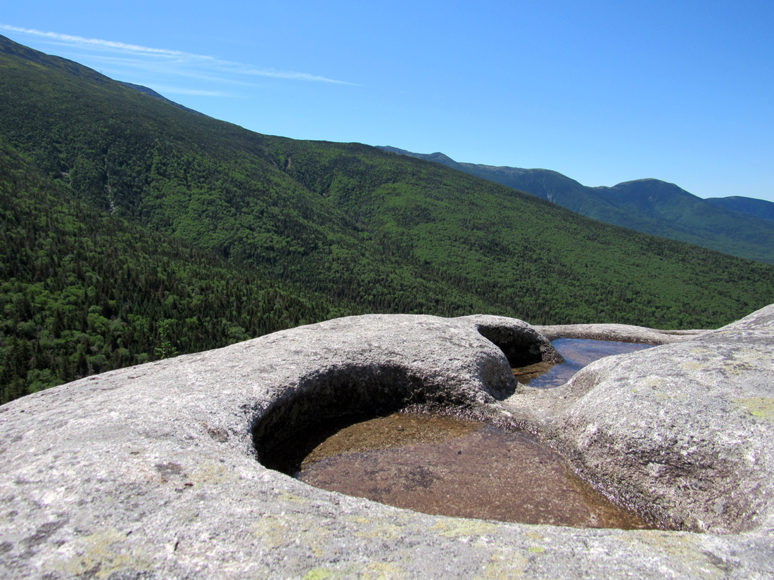
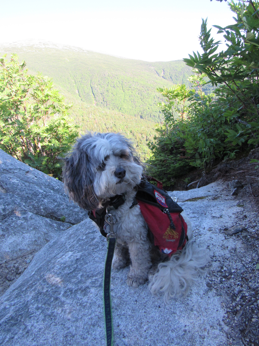
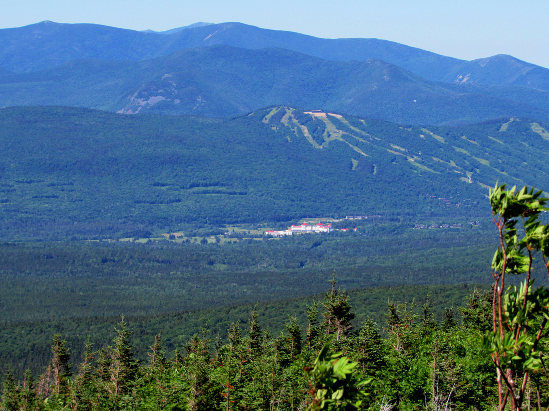
The first part of the hike is in the woods was fairly gentle, gaining 792 ft in just over a mile. At the Pothole Rocks, several boulders that contain holes formed by retreating glaciers from the last ice age, we stopped for a short rest. Patches gobbled up her breakfast while I ate another power bar and took a few pictures, including up to Mt Jefferson and down to the Attitash ski area and the Mt Washington Hotel far below along Rt 302.
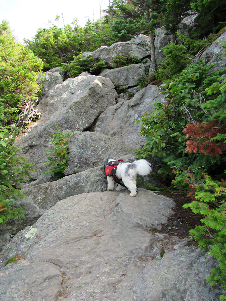
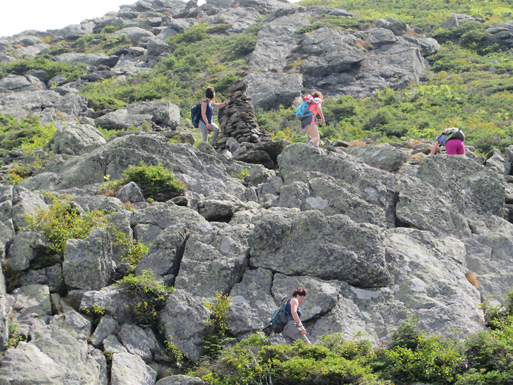
From there, the trail skirts the edge of the ravine, mostly in the woods, until reaching a very steep section up a jumble of huge boulders with many gaps and small boulder caves between and under them, where the trail pretty much breaks out into the open with wide views down toward the Pothole Rocks and Rt 302. Just beyond, we approached the first cap where the trail hugs the side of the ravine and then skirts between two jutting rock formations. Then, after a short dip down, we came to the base of the slab where we had turned around in 2017.
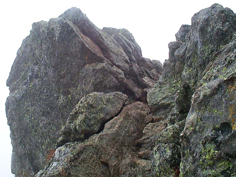
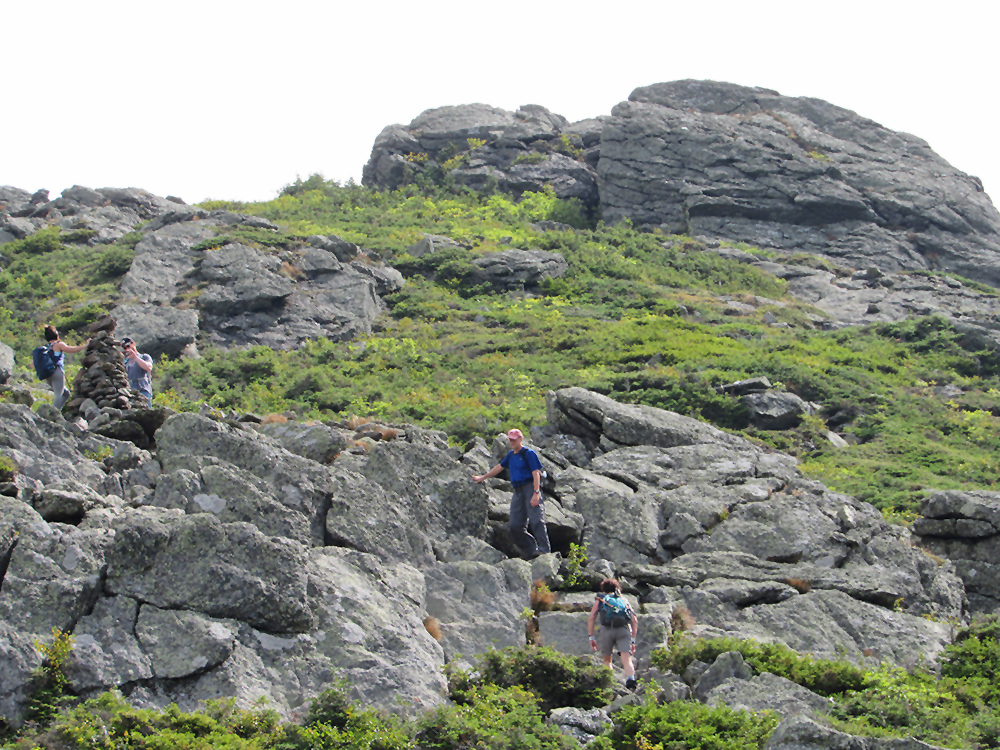
This area, particularly near the bottom, involves some serious scrambling. My sticky rubber approach shoes were a major help and we made it up this time, also noting that there was more than one possible route up the rock face, some easier than others. At the top of this section, by a large cairn, I realized that we were not actually at the top of the next cap yet, but that there was more scrambling waiting for us ahead. The issue in the caps is that you can't see very far beyond each one, so you never really know what lies ahead until you finally come out in the open near the Cornice trail. You keep on hoping you've reached the last cap only to find another cap, or just another rocky approach to a cap, looming ahead.
The wind up in the caps was very gusty and strong, ocassionally making it difficult to stand up straight without hugging onto a nearby rock formation. It was blowing up the ravine from the south side of the ridge. Sometimes, the trail wound its way up along the north side of the rock formations and we'd get a brief respite from the turbulence, but then it would soon cross back over into the full fury of the blasts. I was hoping that it wouldn't be quite so windy up on the summit cone.
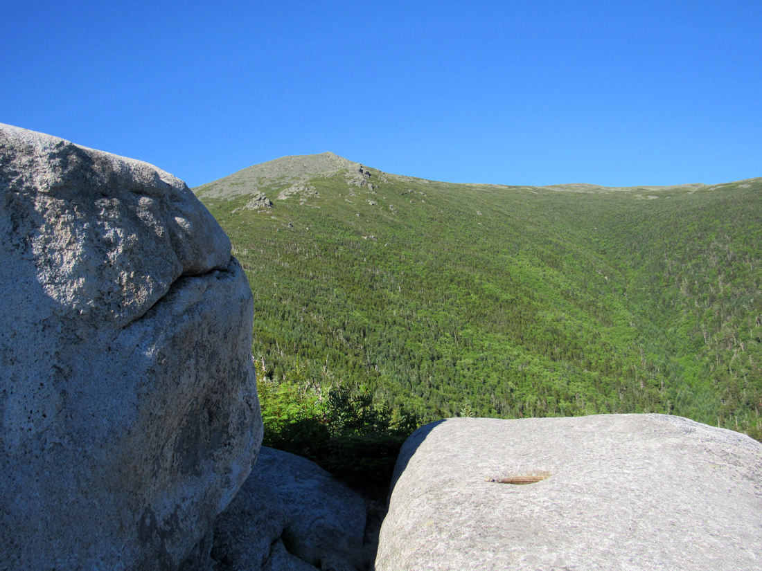
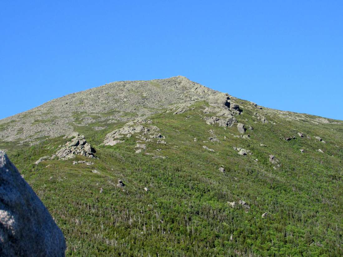
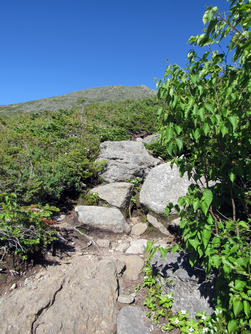
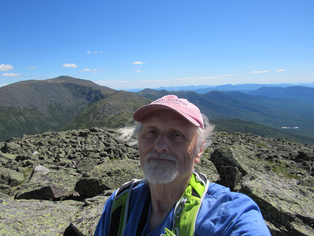
At the junction with the Cornice trail, we sat down for a few minutes to rest, drink a little water, and munch on a few potato chips. It's 4/10 of a mile and just over 700 vertical feet to the summit from this point, but it looked much further than that. There were good views in most directions, including most of our path ahead, although I doubted that I was looking up at the actual summit. As in the caps, it was likely just another rocky outcrop that hid the path beyond.
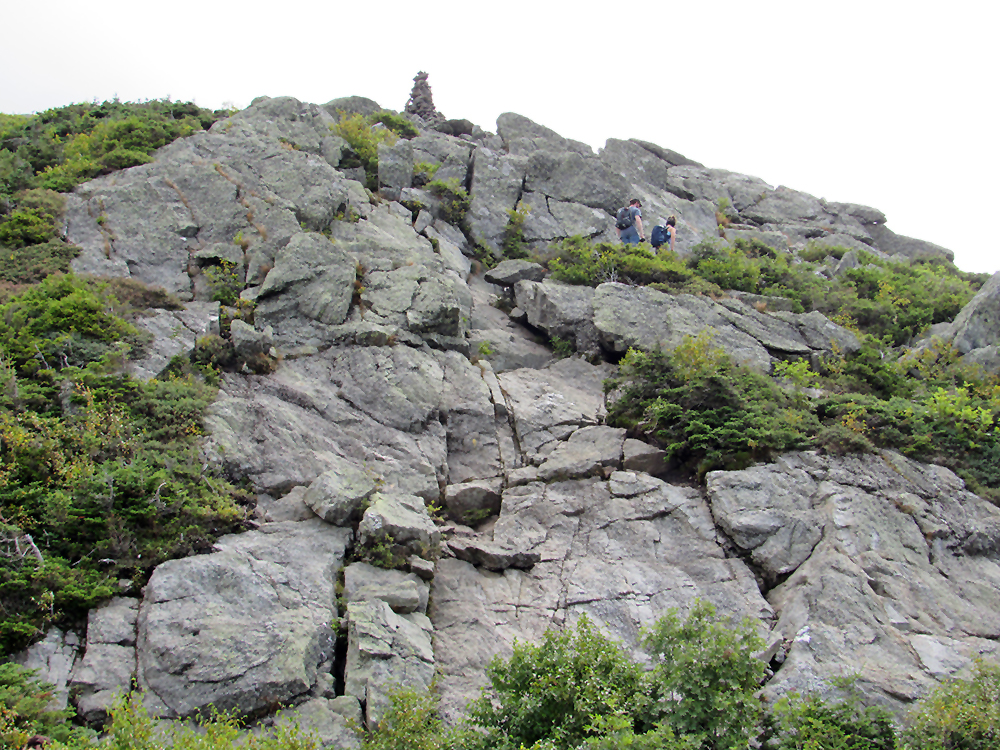
Before today (not including the aborted attempt in 2017), I hadn't been up to Mt Jefferson since Muffin and I climbed it, Adams, and Madison in October 2005. I know that we had made much better time on that trip, but I was 16 years younger then, and it was well before my heart valve replacements. In some places, the trail was structured loosely with stones arranged in a semblence of steps, but in others, there was no appreciable pathway, just a series of cairns to follow where it was up to you to find the best route between them. Clearly, this trail was not built by J Rayner Edmands, who favored gently graded paths with good footing.
Just below the summit, I stopped to have a nice discussion with a woman from Jefferson, NH who was working on her 4000-footer list. We talked about our favorite and least favorite mountains. She also liked Patches, who was very good about staying put for a few minutes. She had come up the Airline from Appalachia, climbing both Madison and Adams, and was now on her way back down the Caps Ridge Trail where there was a car waiting for her at the trailhead.
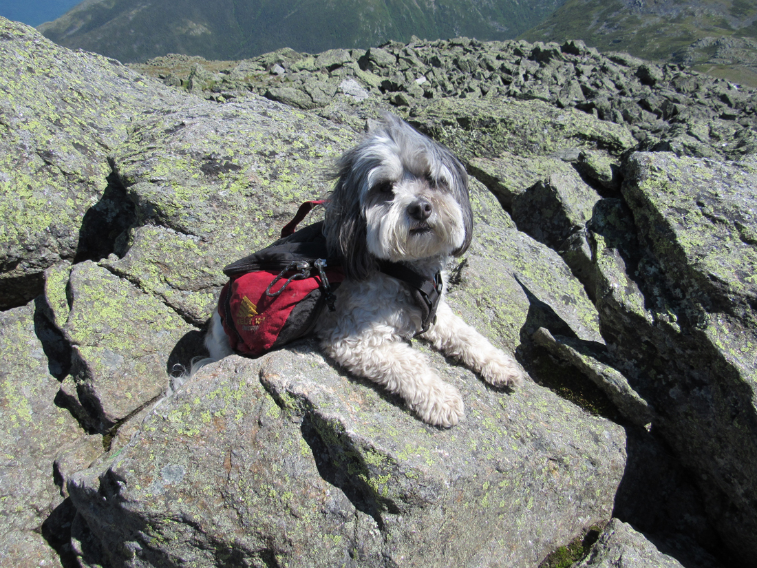
The actual summit is a short trailess scramble up from the the Caps Ridge Trail, which continues about 20 vertical feet down to a huge cairn at the junction of the Mt Jefferson Loop. We had made it. It was still windy but we hunkered down amongst the rocks, got as comfortable as we could, and snacked on another power bar and more potato chips. It was an exceedingly clear day, virtually cloudless, with Washington, Clay, and the Northern Presidentials standing out sharply against the blue sky. Unfortunately, after taking pictures of both Patches and myself, I reached the useable end of storage space on my camera. I fumbled with it for a while, trying to erase older photos, but I'm not used to the menus and I was afraid I'd end up erasing all of today's pictures.
It was a long hike down, with lots of rock hopping and decision-making as to the best and safest route to the next cairn, all the time being careful not to make a misstep that could end in a fall. It was a relief to finally reach the Pothole Rocks again, where we rested for ten or fifteen minutes before continuing on down through the last wooded section of the trail to the parking lot and comfort of our car. Patches was extremely glad to lay down in my lap while I drove back to the campground to retrieve the tent and other gear, and then head wearily, but satisfyingly home, happy with our accomplishment. This was Patches' 40th 4000-Footer with only eight more to go.
|
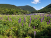
Field of purple lupines next the AMC's Highland Center. |
|