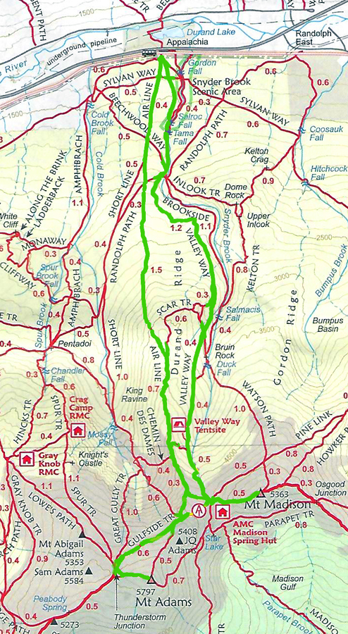
Day 1
Patches only had three more peaks to finish her list. Madison and Adams were two of those. I had hoped to get up there earlier in the season but it had been very rainy and it was hard to find two or three consecutive days with sunny weather. Finally, in late August, a run of good weather was finally in the forecast.
Patches and I drove up to Moose Brook State Park in Gorham to camp for the night. It was the closest campground to the Appalachia Trailhead in Randolph so it was a better choice than Dolly Copp or Sugarloaf.
After setting up camp, we drove down to the AMC Pinkham Notch Visitor's Center, I looked around a while, and then stopped at Walmart in Gorham to pick up a few things. After that, we returned to our tent, I loaded my pack, then we went to bed.
Day 2
My alarm went off at 5:30. We were comfortable so we lazed around for a while, then got up. I took down the tent because we had only paid for one night, then headed over to the Appalachia Trailhead. I ate a couple of oat and honey bars for breakfast on the way. Luckily, I foud a spot in the actual trailhead parking lot, not along the road like so many other cars. After getting our gear in order, we were underway by about 6:30.
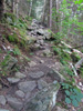
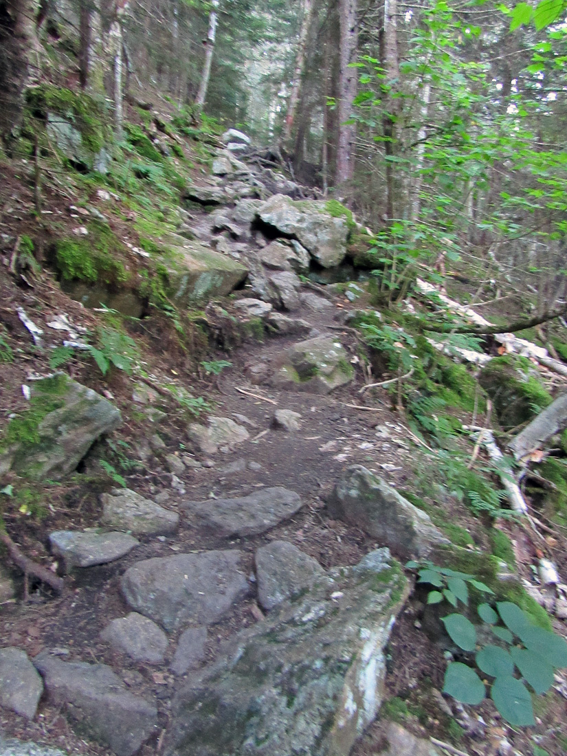
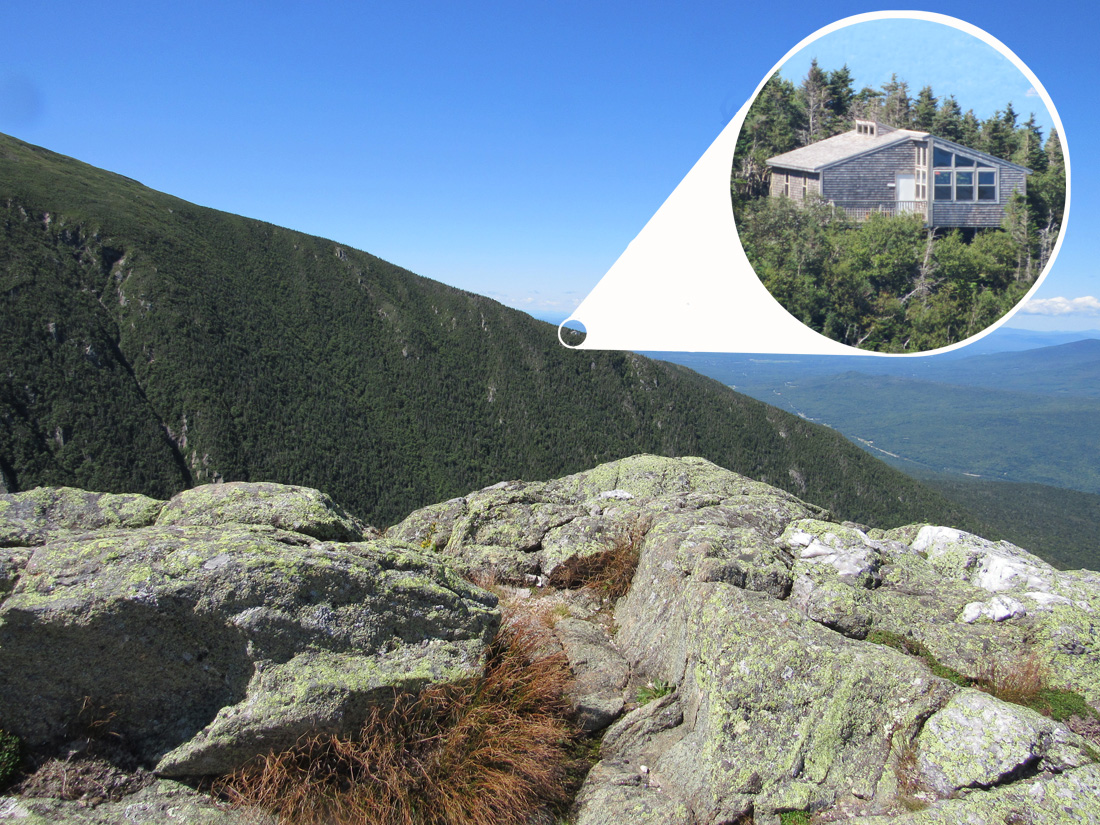
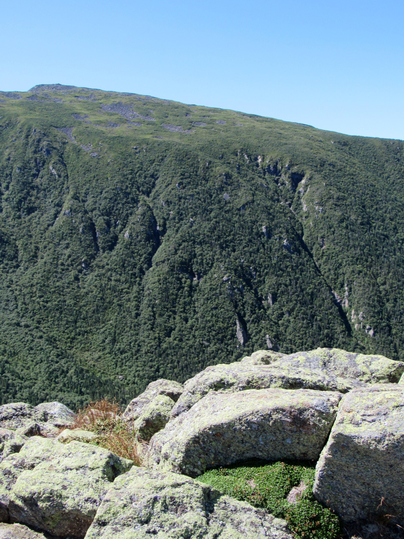
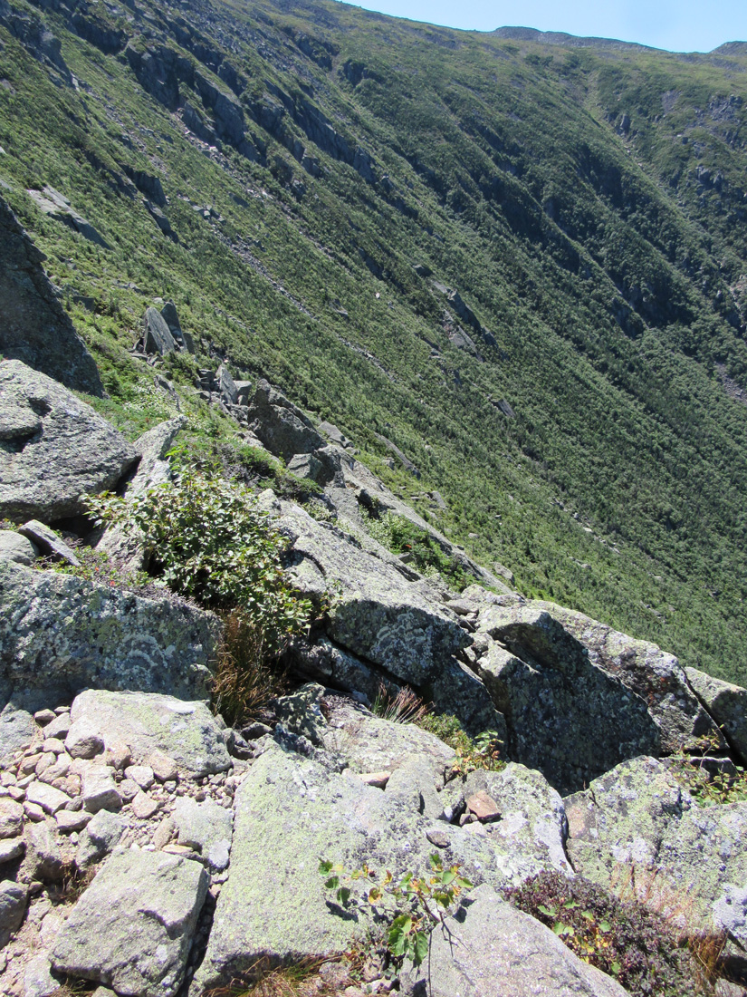
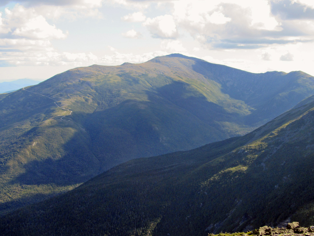
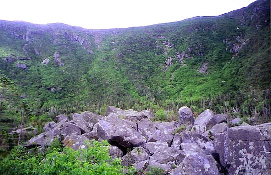
The first part of the trail was easy-going and we made pretty good time, but somewhere around 2500 ft, it started to get steeper and rougher and our progress slowed. It looked like we were getting closer to the edge of King Ravine, but we never seemed to get any closer. It got even steeper around 3000 ft, but we didn't come to the edge of King Ravine until around 4000 ft. We stopped there for a rest and to take some pictures of the ravine headwall and RMC's Crag Camp on the other side of the ravine.
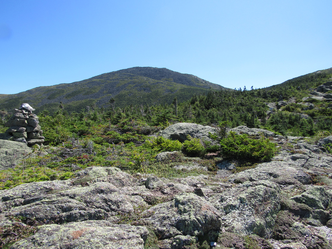
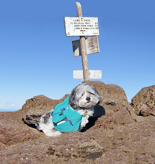
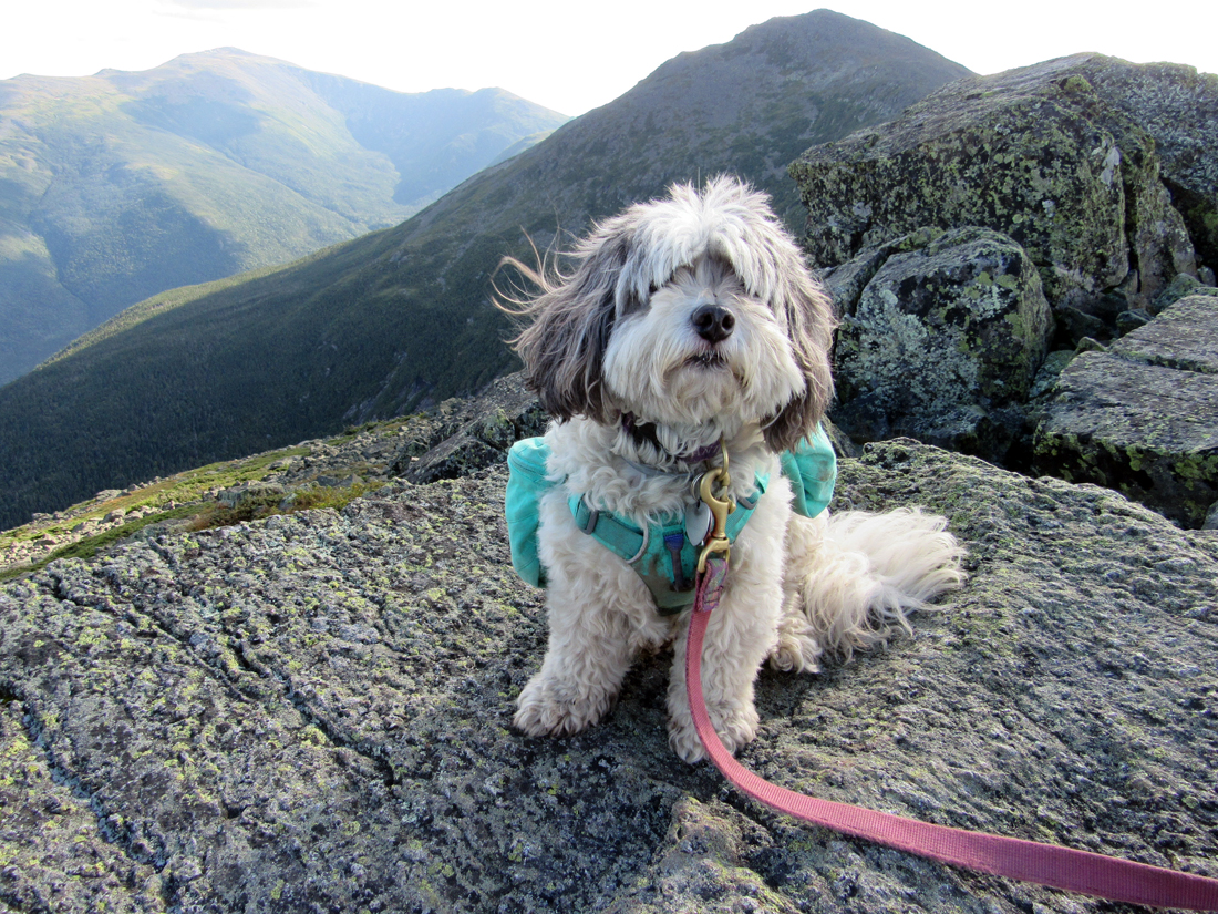
We continued climbing slowly toward Mt Adams, taking the Airline Trail to the Gulfside Trail and then up to Thunderstorm Junction. I don't like approaching the Mt Adams summit via the Airline Trail. I find it less daunting to take Lowe's Path from Thunderstorm Junction. After taking Patches picture, we returned to the Gulfside Trail on then on to Madison Spring Hut where I used the bathroom, bought a hut tee-shirt, filled one of my water bottles, and left my pack there at the hut to make the round trip to the summit of Mt Madison.
I swear that the climb up Mt Madison's summit cone was much slower and a lot longer than the last time I climbed it back in 2013, but I suppose it could also have something to do with either being ten years older or having my mitral and aortic heart valves replaced back in 2016. We rested at the top for a while and I ate a few Pringles and we both drank some water.
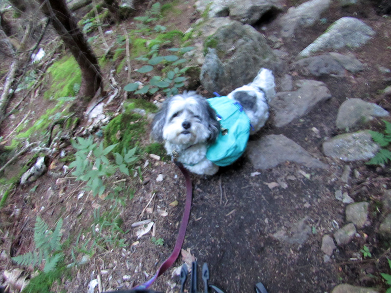
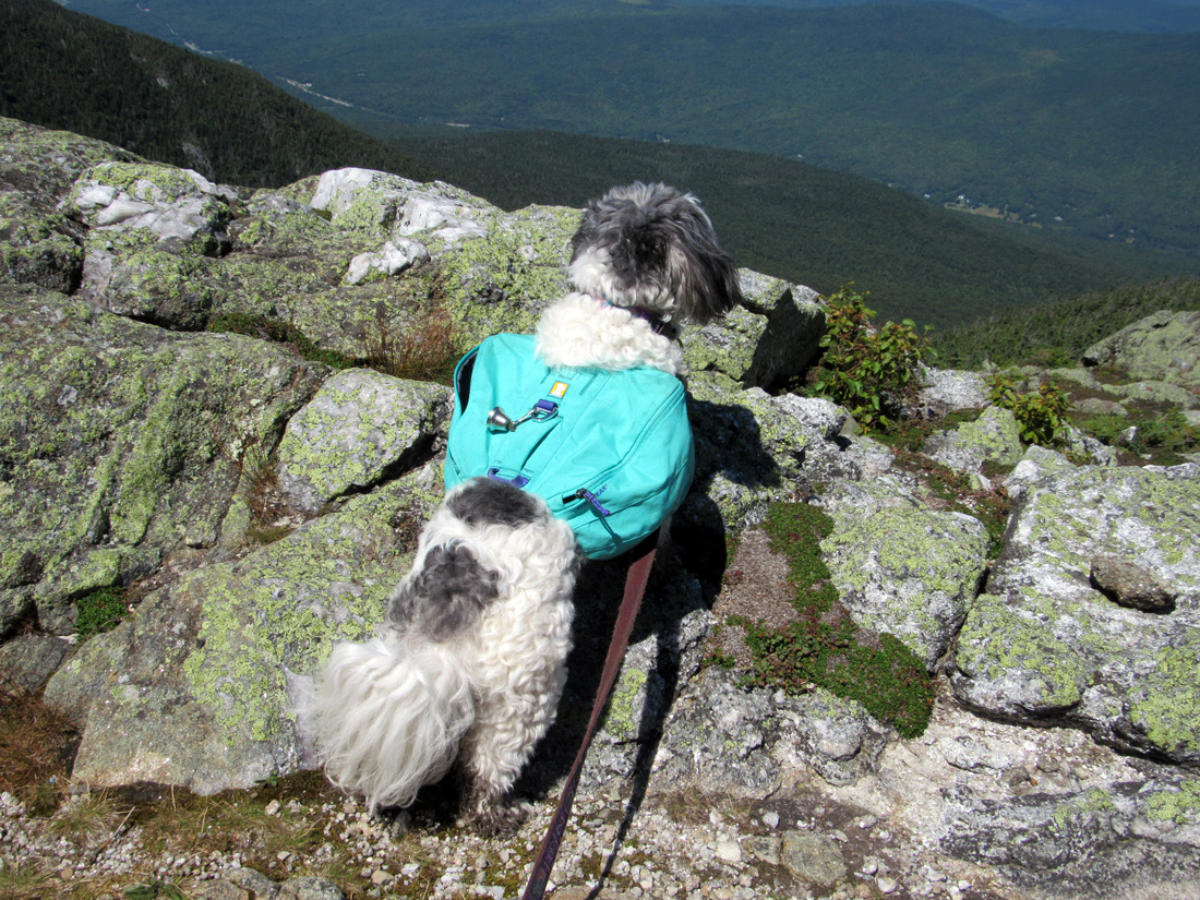
After returning from the summit, we stopped at Madison Spring Hut again to refill our water bottles. Our plan was to quickly hike down nearly 5-miles and 3500 feet of elevation on the Valley Way Trail but we we didn't get started until around 6:30 PM). I knew we wouldn't make it before dark, but I'm used to hiking at night with my headlamp and I figured we could still make good time. Patches had been doing fine all day but after going just under a mile (just above the Lower Bruin Trail junction), Patches started getting really slow and kept trying to lie down. I assumed her feet were getting sore due to the sharp rocks on Madison.
I sat down and put her in my lap but I wasn't sure what to do next. She has booties but refuses to wear them. Then a hiker named Sean and his daughter, who were on their way up to the hut, stopped and tried to help bandage Patches feet, but Patches didn't like that at all and the bandage wasn't sticking well anyway. Then he helped me figure out a way for me to carry Patches down in my backpack. I was only wearing a day pack, and it was pretty full already, but Sean took some of the stuff that I didn't need from my pack, and after storing it in a bag of his own and hanging it in the woods, helped me get Patches into my pack. He said he'd mail the the gear back to me in a few days.
Luckily, Patches only weighs about 17 lbs but because her head was sticking out the top, the pack was still a little top-heavy. I thanked Sean and his daughter and started down but had to go really slow and step carefully on the damp rocks. Even so, I slipped a couple of times and had to take my pack off and secure Patches in it again before continuing on my way.
Around 2:45 AM, over eight hours after leaving the hut, we reached the area where the Valley Way, Beechwood Way, and the Randolph Path meet. Even with my headlamp shining brightly, I couldn't find a sign that pointed out which of the trails was the Valley Way. So, after a couple of tries that didn't seem right, and after I ended up stepping in water that went over the top of my boot, I gave up and sat down among some rocks with Patches in my lap. We were both wearing warm coats so we weren't cold. As I said, we had been hiking since 6:30 AM on Wednesday so, other than a couple of short rests, we had been at it for over 20 hours.
Day 3
I wasn't worried because I knew we'd be able to figure out the correct way to go when it got lighter. After turning off my headlamp, I could see a number of bright stars through the tree branches. Other than that, it was pitch black. I'm neither afraid of the dark nor of being alone in the woods, so the only real issue was that I was completely exhausted. Besides the time of day and the number of hours we had been hiking, it had been extra stressful and tiring carrying Patches and working harder than usual to stay upright. I didn't want to slip and hurt Patches.
We ended up falling asleep propped up against a couple of uncomfortable but dry rocks. I woke up around 5 AM and it looked like the sky was just beginning to get a little lighter but it was still dark in the woods. Sometime between 5:00 and 5:30 AM, I noticed a light moving, apparently down a trail, in back of me. I was sure it was someone's headlamp coming up the Valley Way. I called out to them, hoping they would be able to point me in the right direction. Nobody replied, so I tried calling out again. The light stopped moving, as if the hiker had stopped along the trail, but then suddenly rose slowly straight up in the air and disappeared. Swamp gas? I don't know. It sure looked exactly like a hiker's headlamp. Oddly enough, I wasn't frightened; I.just fell asleep again. But I'm sure it hadn't been a dream.
Later, closer to 6:00 AM, I woke up again and heard voices. I called out to them. They had just come from Appalachia, and pointed out the Valley Way to me. The nap had helped Patches and her feet didn't seem to be bothering her any more. She ended up hiking the rest of the way to the trailhead without needing my help. We got back to the car around 7:45 AM, After making some calls to say where we were, we drove just under an hour to Lincoln, got something to eat from McDonald's, and then parked behind a Dunkin' Donuts where I slept another couple of hours until I felt awake and safe enough to drive the rest of the way home. The drive wasn't too bad except for a 30-minute backup on I-93 in Boston between the tunnel and Rt 128. It was good to get home again, and after taking a shower, I went back to bed.
|
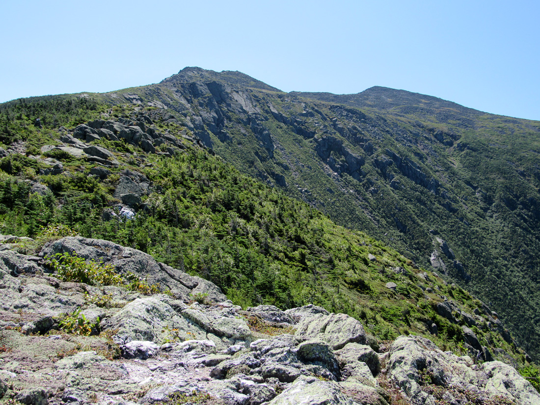
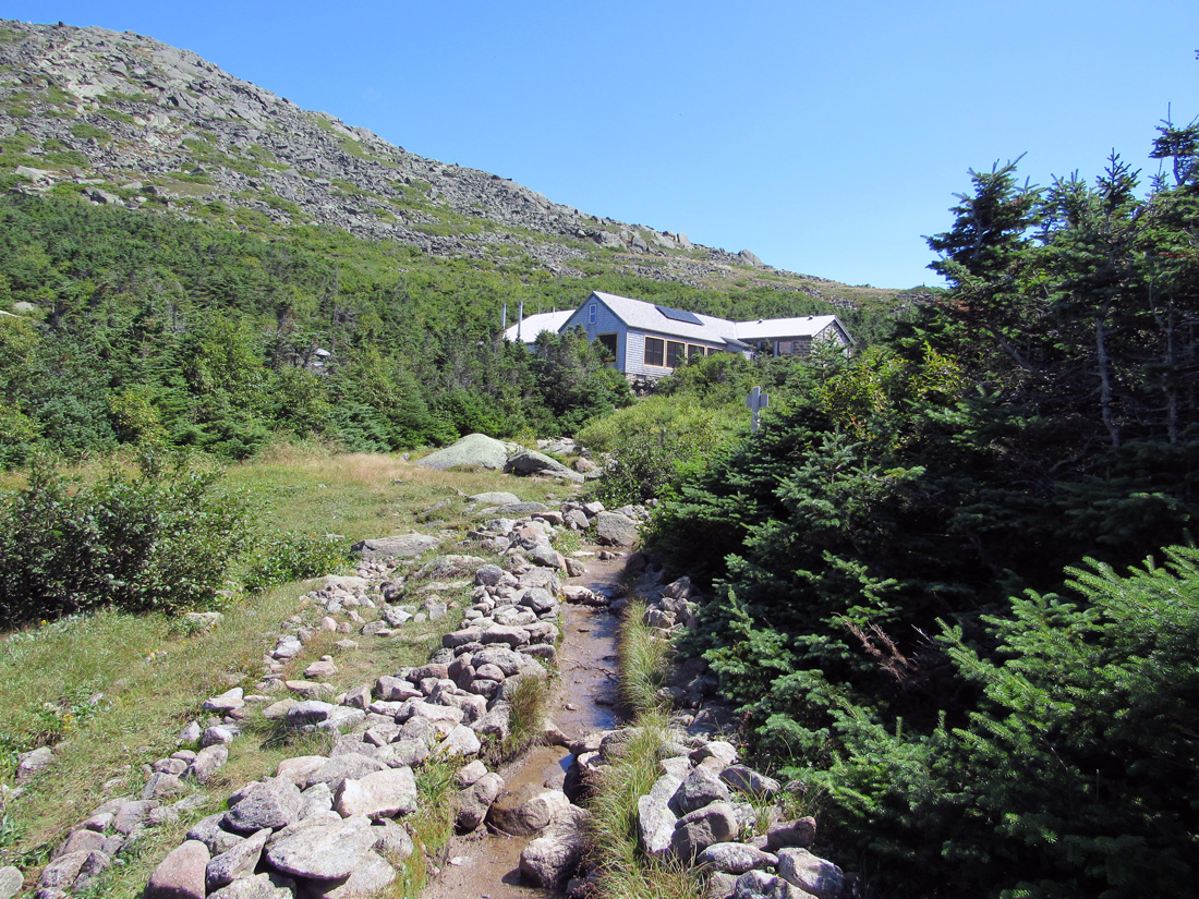
The Airline Trail, probably between 3000 ft to 3500 ft of elevation.
|
|
