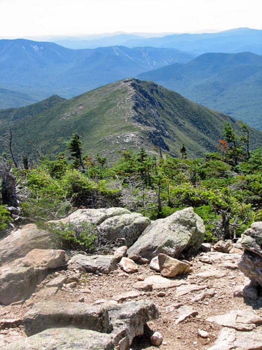
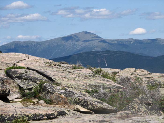
My next stop was Mt Bond itself, a short
uphill hike on the Bondcliff Trail from its junction with the West
Bond Spur. Like West Bond, this peak has 360 degrees views, but it
lacks the isolated "top of the world" feel of West Bond. There are,
however, much better views of the eastern half of the Pemigewasset
Wilderness, including Mt Carrigain and Willey Range.
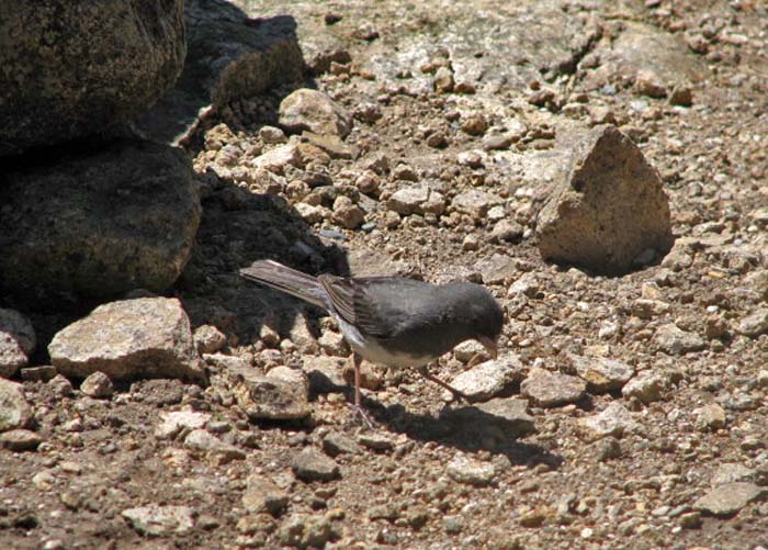
I sat down on the rocks for a short
rest and snack, and was soon visited by several Juncos.
Generally, there are large numbers of Gray Jays on the peaks,
but on that day, there were several Juncos hanging around. They
didn't seem to be looking for handouts. They were just walking
around pecking at the ground. Maybe they found some insects
amongst the rocks.
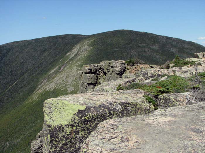
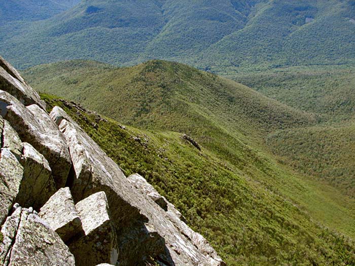
Soon, it was time to tackle the
traverse over to Bondcliff, which follows a so-called
"knife-edge" ridge that is actually not all that narrow. The
more difficult part of this journey is the rocky climb down the
south face of Bond over its large boulders. I hadn't seen anyone
on the summit of Mt Bond, but passed several hikers on their way
up to it along the ridge. After hiking for a number of hours, I
was glad to be heading the other way; the climb up to Bondcliff
is not nearly as arduous.
On Bondcliff, the air was still
amazingly clear. Other hikers I had met on the trail throughout
the day had also made comments about it, so everyone was
enjoying a rare day in the mountains. Mt Washington stood out so
clearly that it looked close enough to reach out and touch.
Gazing south, the Bondcliff ridge
tapered down into the Pemigewasset Wilderness. The trail roughly
follows this ridge down to the valley of the East Branch of the
Pemigewasset and the Wilderness Trail far below.
Normally, I'm quite tired by this
time in a hike, but my strength was holding out fairly well as I
made the descent down the Bondcliff Trail. Perhaps it was due in
part to the invigoratingly clear air, or maybe because I knew
there was still a long way to go. Whether I'm on a 10-mile hike
with 4000 feet of elevation or a 5-mile climb of 2000 feet, I
usually get tired about halfway down the trail on my way back,
so there must be something psychological about it.
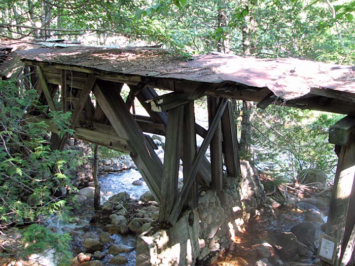
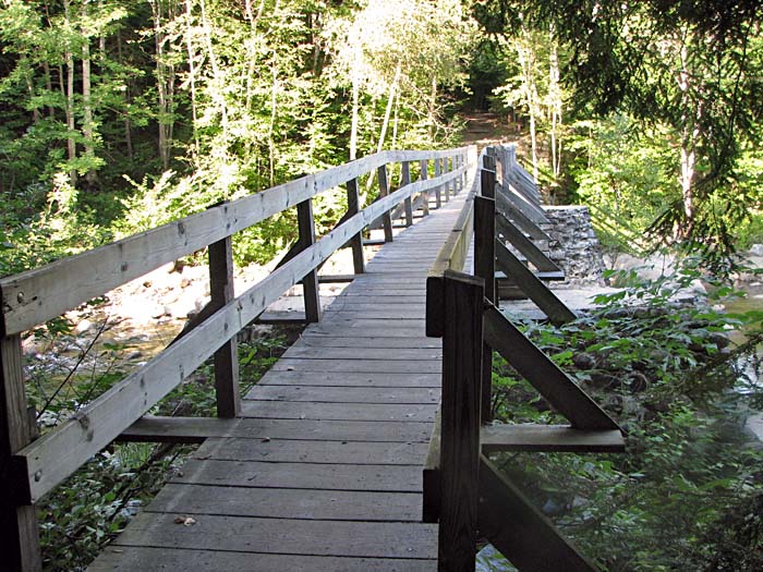
After reaching the Wilderness Trail, I
took a short side trip over to the old railroad bridge over
Black Brook. Unlike my last trip to this area, no orbs showed up in the photographs
of the bridge. However, pausing for a few minutes at the trail
junction, I could swear that I heard the low murmur of
whispering filtering through the woods around me, even though
there was definitely no one around. It may have just been the
musical babbling of Black Brook, but I can't help but feel that
there's something hauntingly other-worldly, though not
frightening, about this spot. I've never had that feeling in
other areas of the mountains.
The long hike out the Wilderness Trail
went by fairly quickly, though I began to get a bit tired after
crossing the suspension bridge at the boundary of the
Pemigewasset Wilderness. The most tiring part of the trip was
yet to come, though, because when I reached the Lincoln Woods
Trailhead, I couldn't get a cell phone signal to call The
Shuttle Connection in Lincoln. I ended up walking all the
way down the Kancamagus Highway to Loon Mountain before I was
able to make the call and get a ride back to my car on Zealand
Road. |
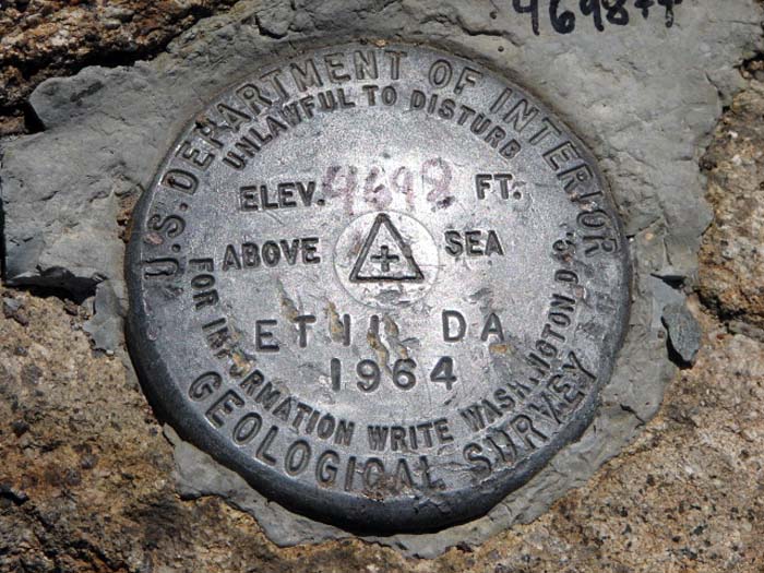
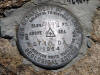
USGS summit
marker on Mt Bond. Like West Bond, this peak has 360 degrees
views, but it lacks the isolated "top of the world" feel of West
Bond. |
 |