|
We
had been planning this trip for several months, as Toi wanted to climb Mt
Washington and get the t-shirt after she had worked hard during the past
year to lose weight and get in better shape. We chose this particular day
because our daughter Holly, who did not want to climb the mountain, was at
music camp in Maine, and we were planning to visit her on Sunday. We drove
up to the White Mountains on Thursday after work, and spent the night at
the Dry
River Campground in Crawford Notch State Park.
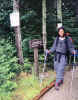
The
next morning, we woke up around 7 AM, had a quick breakfast of oatmeal,
then drove several miles up to the Ammonoosuc Ravine Trailhead on the Cog
Railway Base Road. Our plan was to hike up the Ammonoosuc Ravine Trail to
Lakes of the Cloud Hut, continue up the Crawford Path to the summit, the
loop back down to our car via the Gulfside and Jewell Trails.
The
weather wasn't looking all that great at the bottom, but the temperature
was nice and it wasn't raining. We hoped that it would stay dry, even if
it was going to be cloudy. We made good time on the lower part of the
trail, but were passed a couple of times by faster hikers, and I just knew
that it wasn't going to be one of those days when you have the trail all
to yourself.
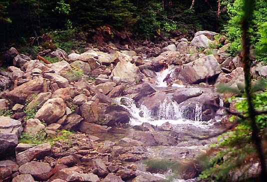
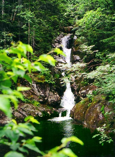
We
stopped at Gem Pool for a short rest and snack, but it wasn't as enjoyable
as it could have been. In the five minutes we spent sitting on some large
rocks trying to admire the falls, three or four groups of hikers passed
by, including one guy who was wearing flip-flops. Toi didn't mind the
crowds, as she wasn't really used to climbing and preferred having others
around. I, on the other hand, would rather have enjoyed the tranquility of
an uncongested trail.
|
Ammonoosuc
Ravine Trailhead. We were planning a loop trip that involved returning via
the Jewell Trail, which begins at the other end of the trailhead's parking
lot. |
|