|
For me, this was the start of a long Fourth of
July holiday weekend. I took Friday off of work, and wouldn't have to go
back until the following Thursday. And since our family was going out on
Friday evening, I drove up Thursday night and spent the night in
bunkroom in Joe Dodge Lodge at Pinkham Notch so I could get an early
start.
In the morning, I got dressed quickly, ate a
power bar, and was out on the trail by a quarter to five. I didn't have
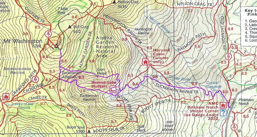
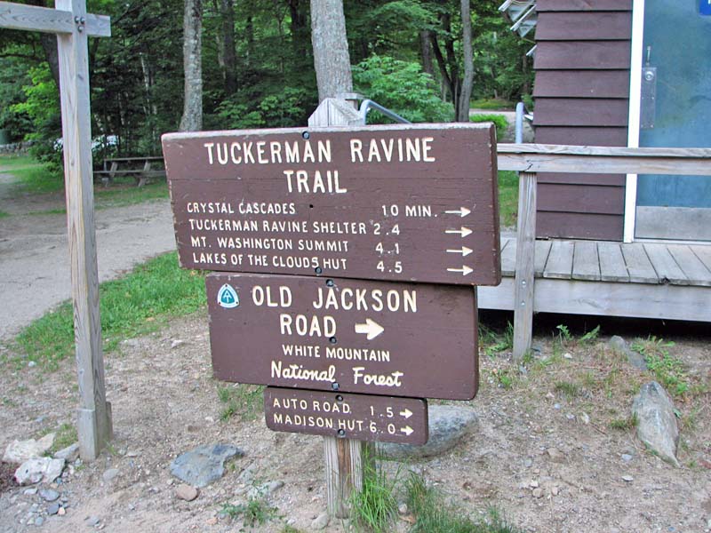
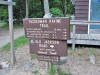
far to go to get to the trailhead, as the Tuckerman Ravine Trail begins
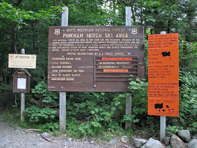
right in back of the Visitor Center. I stopped to take pictures of the
trail and ice warning signs, then started up the trail. It was a quiet
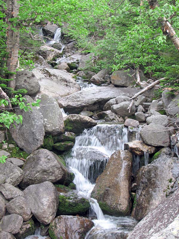
early summer morning, and I even saw a fox on the trail before reaching
Crystal Cascade. He probably didn't expect anyone walking around that
quite that early.
I was really looking forward to climbing Mt
Washington from the east. I had climbed up the western slopes on the
Ammonoosuc Ravine Trail a couple of times, but had
never ventured beyond Hermit Lake on the Tuckerman Ravine Trail, and that
was during the winter.
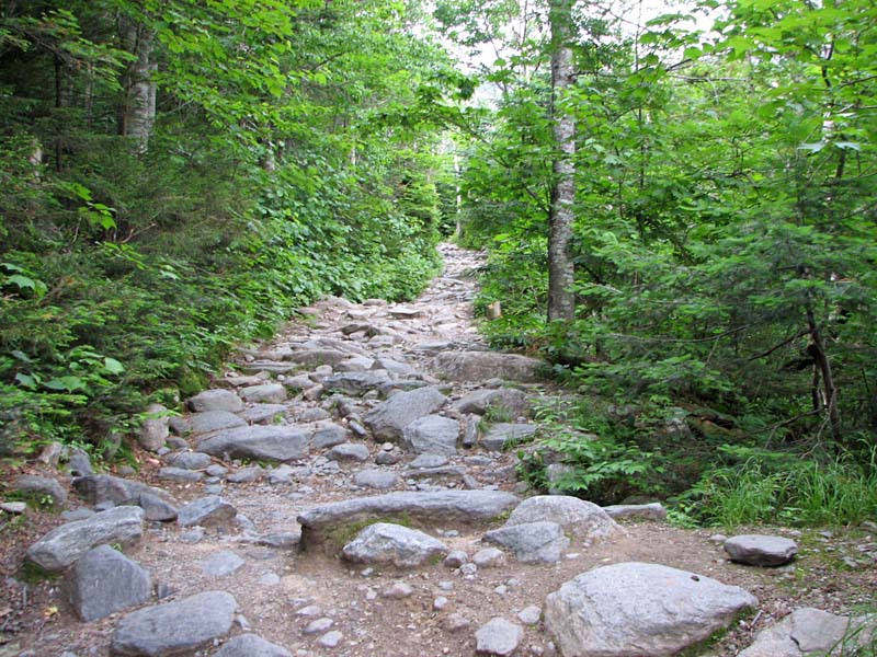
As expected, the trail was wide and the hiking relatively
easy, considering the "moderate but relentless" climb as described in
the White Mountain Guide. The lower
part of the trail, from Pinkham Notch to Hermit Lake, is extra wide to
accommodate snow tractors, which are used by snow rangers and for rescue
operations. Due to its popularity, especially during the winter ice
climbing and spring skiing seasons, there are quite a few rescues
carried out in the ravine every year, many due to avalanches.
At Hermit Lakes, I stopped in at the ranger
station, which is known as HoJos, to check on their t-shirts and other
souvenirs. I saw one I liked but figured I'd stop on the way down to buy
it.
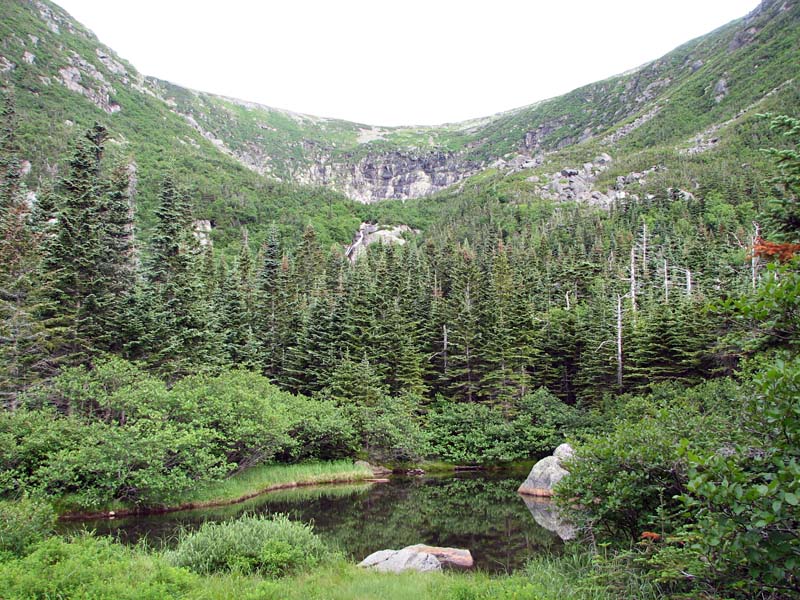
From HoJos, there's
a great view up to the ravine headwall. The headwall, known as the Bowl
to skiers, is a wide horseshoe-shaped glacial cirque. It's an imposing
sight, all the more so when you think about how deadly it can be.
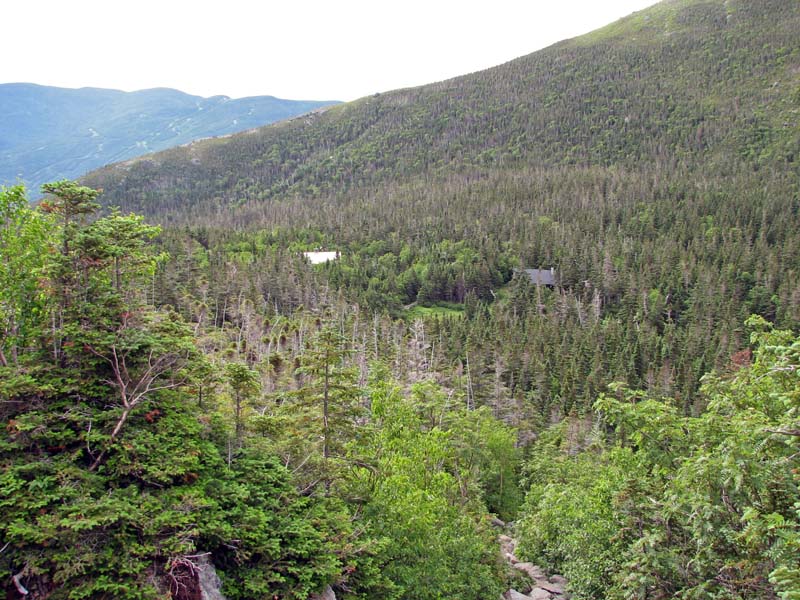
Partway up the slope beyond Hermit Lake, I
stopped to admire the view back down. Besides HoJos, the Hermit Lake
complex consists of the AMC Hermit Lake shelters and tent platforms, and
an emergency first aid cache. |
Trailhead. The
Tuckerman Ravine Trail begins right in back of the AMC's Pinkham Notch
Visitor Center. |
 |