|
It wasn't too much further to the summit
from the Lion Head Trail junction, and after sweating my way up this
final pitch, I emerged onto the auto road just below the summit
buildings. One final climb up an endless stairway and I had arrived. I
went right into the Sherman Adams Visitor Center and plopped my pack
down on a table to take a well-earned rest.
Actually, I'm not very good at sitting still
for very long, so I soon got up to buy a soda and take a look around in
the two gift shops, one on the main floor, and the other, which belongs
to the Mt Washington Observatory, downstairs. I bought a "This Body
Climbed Mount Washington" t-shirt in the Observatory shop, then headed
back upstairs.
In
the cafeteria area, I met a guy who had summitted around the same time I
did, and we got into a discussion about which was the best way back
down. I told him that I was thinking of taking the Lion Head Trail down,
which he thought he had heard was too steep for descent. I told him that
the trail he was probably thinking of was the Huntington Ravine Trail,
which is definitely very steep and highly discouraged as a descent
route. He was from Colorado and this was his first time in the White
Mountains, so all the trails were new to him.
After signing the hiker register at the
front desk, I walked back outside to take a few more pictures. As usual,
the area around the actual summit was insanely crowded, mostly with
tourists who had driven up or taken the cog. I gave up on getting a
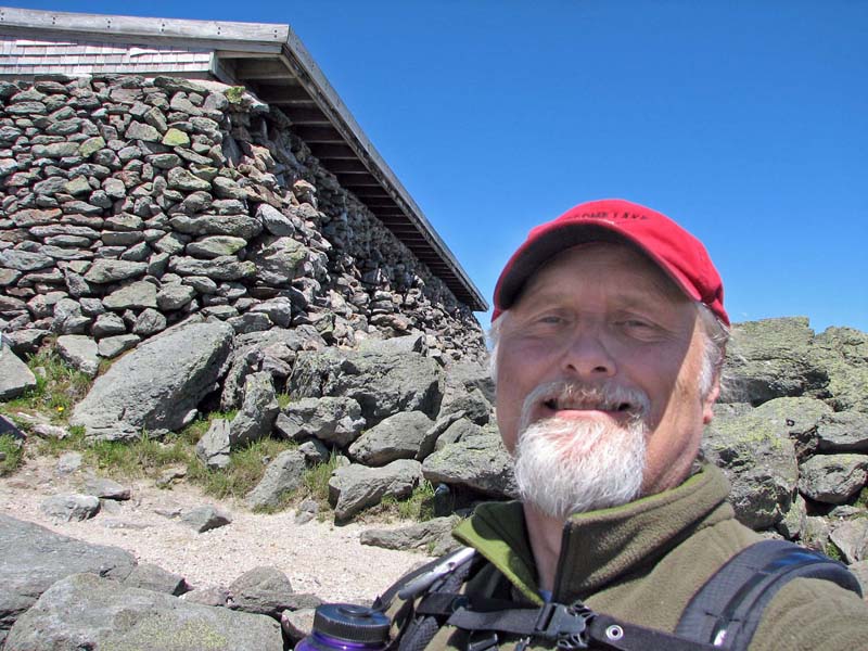
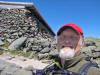
photo there and took my own picture in front of the Tip-Top House, a
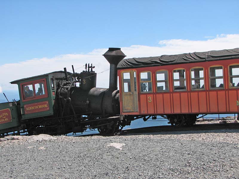
former hotel that was now a museum. Naturally, I took the obligatory
picture of a cog railway train, and with the air so clear, several
pictures of the Northern Presidentials, jutting up into the blue across
the wide chasm of the Great Gulf.
Then it was time to start back. I retraced
my steps down the Tuckerman Ravine Trail to the Lion Head Trail
junction, where I met up again with the my new acquaintance from
Colorado, who was still mulling over which route to take. After talking
to some hikers who were coming up the Lion Head Trail, he decided to go
that way, so we headed down together.
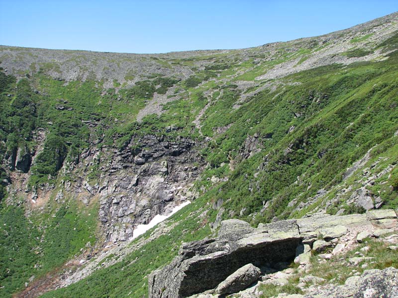
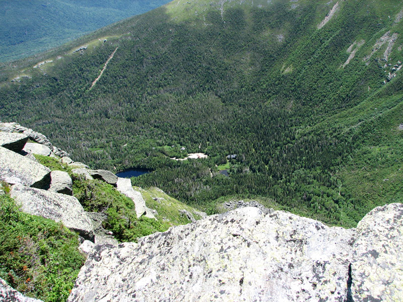
The views from on top the Lion Head were
spectacular. From that angle, you could get a clearer idea of just how
steep the ravine headwall really was. And over a thousand feet straight
below, tiny Hermit Lake and its myriad toy buildings waited expectantly.
He had a camera too, a much better one than
I did, and took numerous photos from atop the precipice. He was amazed
how much rugged alpine terrain there was in the White Mountains,
considering their much lower overall altitude than the Rockies. He had
watched the movies on the summit that show how strong the wind can get,
and was highly impressed.
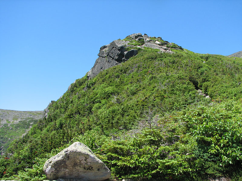
Below the Lion Head, there were several
rather steep sections, including one with a ladder, but nothing that was
particularly daunting. Finally, back down at the wide tractor road of
the Tuckerman Ravine Trail, we made good time back to Pinkham Notch. We
split up at Crystal Cascade; he wanted to take more waterfall pictures
in the afternoon light, while I was in a hurry to get home to meet my
family for the start of the holiday weekend. |
Self-portrait on
the summit of Mt Washington. The building behind me is the Tip-Top
House, a former hotel and now a museum. |
 |