Day 1
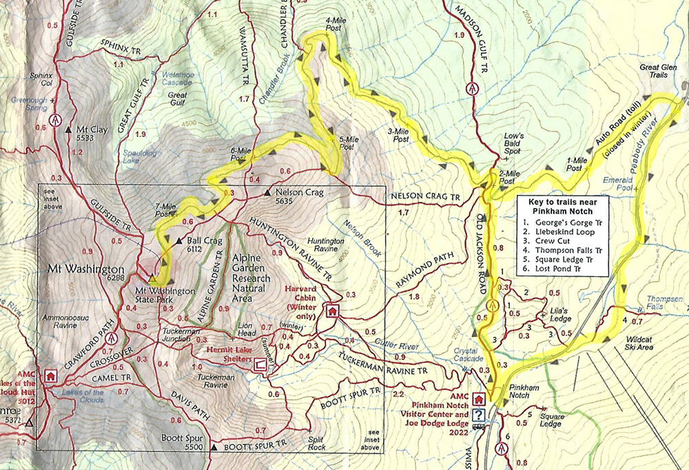
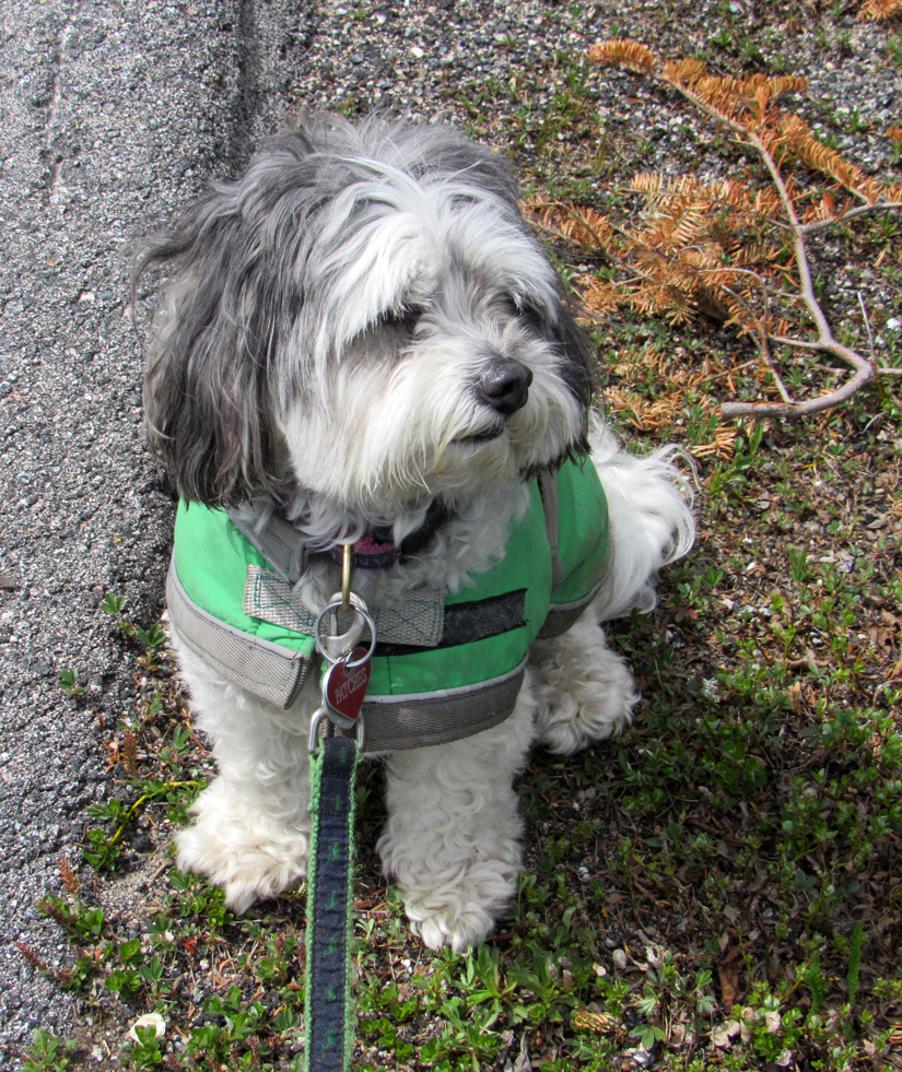
Patches had only seven peaks (Washington, the Bonds, Madison & Adams, and Isolation) left to complete her 4000-Footers, and I wanted to finish all of these in 2022. We had begun her quest in 2014, just after Patches' first birthday, on Mt Waumbek, but for the past three years, various health issues and obligations, as well our move to Cape Cod, had limited our progress. Washington was my choice for the first climb of the year, partially because we could hike up the Mt Washington Auto Rd and avoid any remaining ice, snow, and/or decaying monorail from the winter. We planned to camp overnight at Dolly Copp, and then in the morning, take the Old Jackson Rd trail from the AMC Pinkham Notch Visitor Center to mile 2 of the Auto Rd, and then on to the summit. The Auto Rd was still closed to tourist traffic during the week, so this was a good time to try this route.
When we got to Dolly Copp, we discovered that it was still closed until the coming Memorial Day weekend, so we had to settle for camping at the adjacent Barnes Field Campground, usually reserved for group camping. After setting up the tent, we drove to the Pinkham Notch Visitor Center so I could look around in the store for a while. I left Patches' supper out for her in the car while I was gone, after which we headed to McDonald's in Gorham to get my supper.
Back in the tent, we had settled in for the night; I was reading and Patches was all cuddled up and cozy on her sleeping bag. Suddenly, there was a loud hoarse barking-like animal cry out in the woods that I first took to be a coyote. When the sound was repeated in the same way a few times at regular intervals, first getting closer and then moving away again, I realized that it was actually an owl, just not the familar hooting of a great horned owl. After looking up owl calls on my phone, I discovered that this was a barred owl, whose call was described online as sounding like "Who cooks for YOU" but to me still sounded like a coyote or dog trying to mimic an owl. After some ten or fifteen minutes of this, there was a similar, but slightly higher-pitched owl call not far away. Suddenly, it sounded like a massacre was taking place in the woods nearby, as if the two owls were either fighting or working together to subdue some unlucky prey. Then finally ... silence!
Day 2
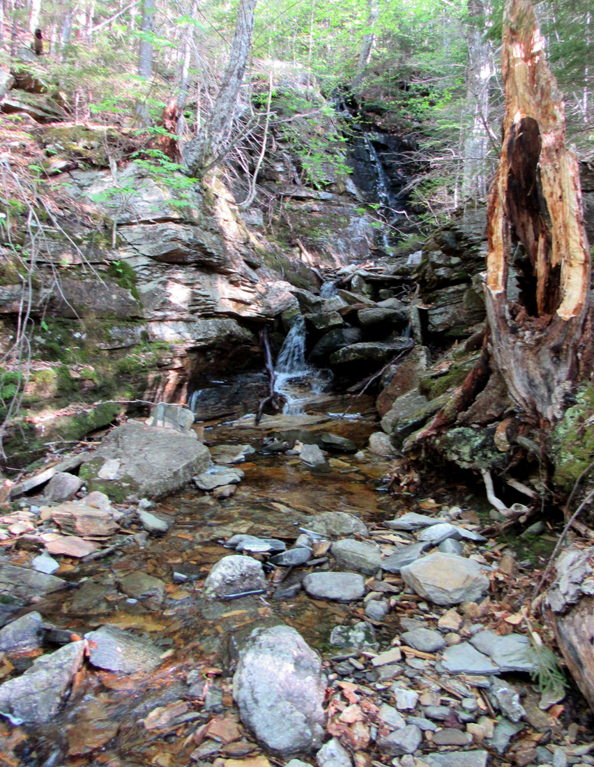
In the morning, we set off around 6:30 AM, drove to the Pinkham Notce Visitor Center and the start of Old Jackson Rd, which begins right next to the Tuckerman Ravine Trail. The trail began with several minor ups and downs, an ocassional brook crossing, and junctions with a couple of short scenic side paths. Eventually we started climbing moderately, passed over a brook with a small cascade on stepping stones, and then climbed steeply past two major trail junctions (Raymond Path and Nelson Crag Trail) before descending into the mile 2 car parking area on the Auto Rd (elevation 2,675 ft).
Here began the long haul of climbing moderately up the road's pavement for the next 5.6 miles and 3,613 ft of elevation gain. It was fairly easy walking, with no ledges, no rocks, and no roots, but there's something about walking continuously on asphalt that tends to drain the energy from your feet. Each step is identical and compresses the same locations on the souls of your feet. Despite two pairs of socks, the relentless footfalls eventually catch up to you.
Somewhere after passing mile 3 on the Auto Rd, we began to hear and then see huge dump trucks carrying asphalt slowly grinding up the road, each five or ten minutes apart.. Patches and I carefully waited off to the side for them to pass. I figured that they were headed up to the summit to dump their load as part of some parking lot or other maintenance. After a while, we spotted a woman slowly running uphill about a quarter of a mile behind us. Eventually, she caught up to us and we talked about the trucks, of which she had already been forewarned. She was training for a race up the mountain but was beginning to have doubts as to her abilities.
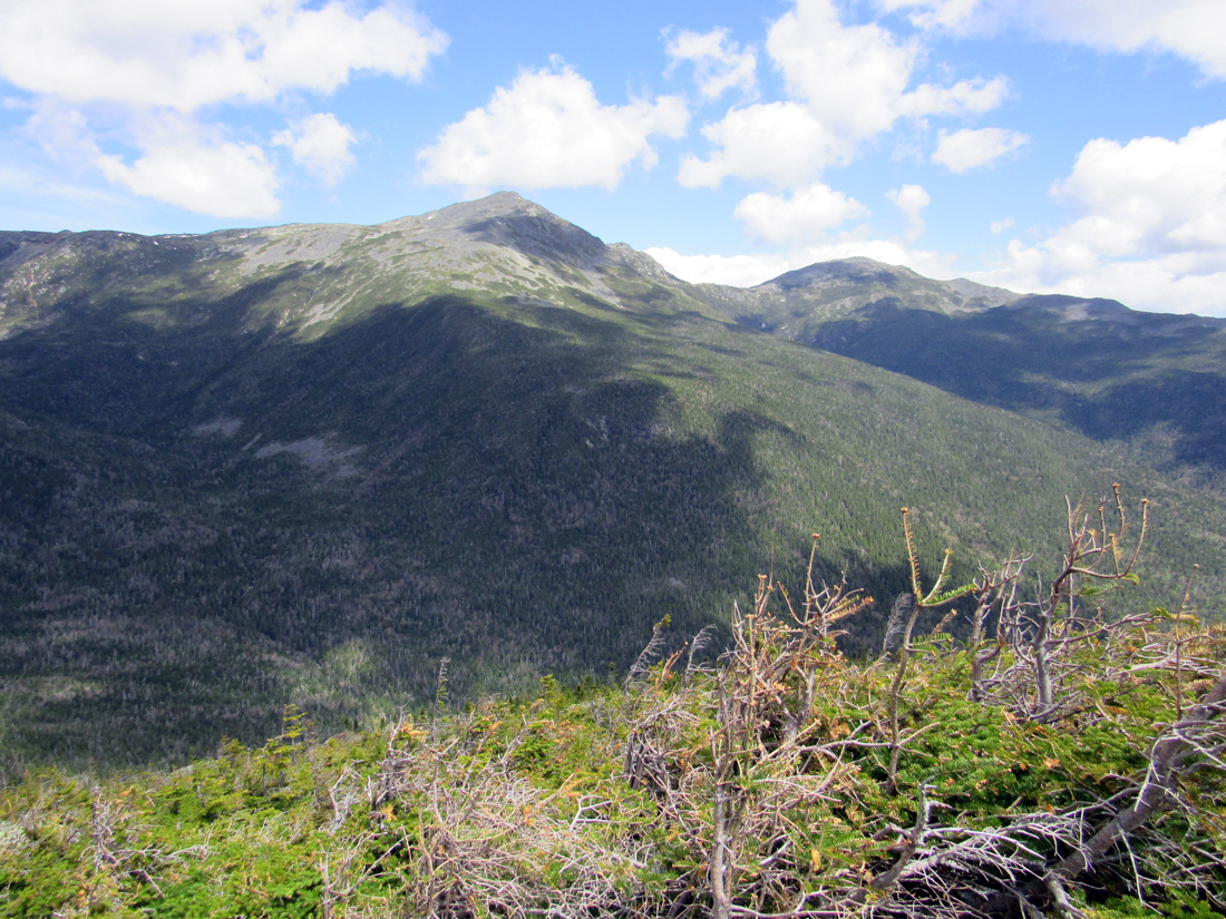
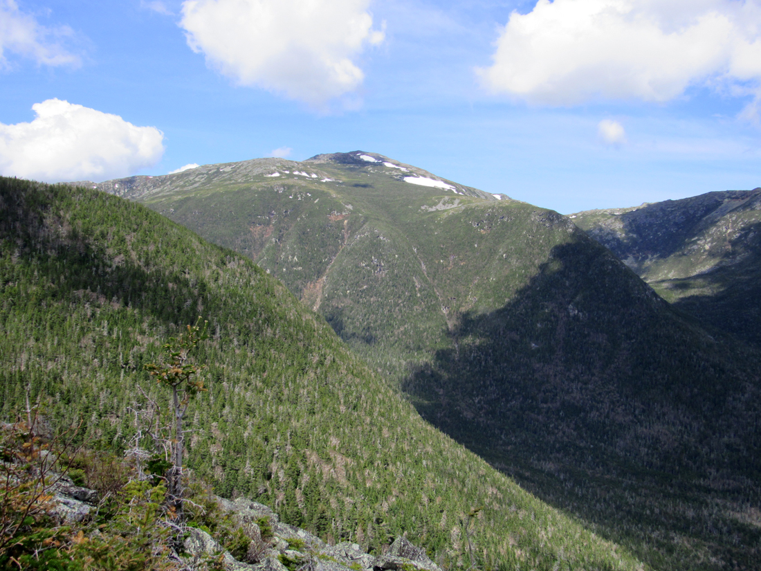
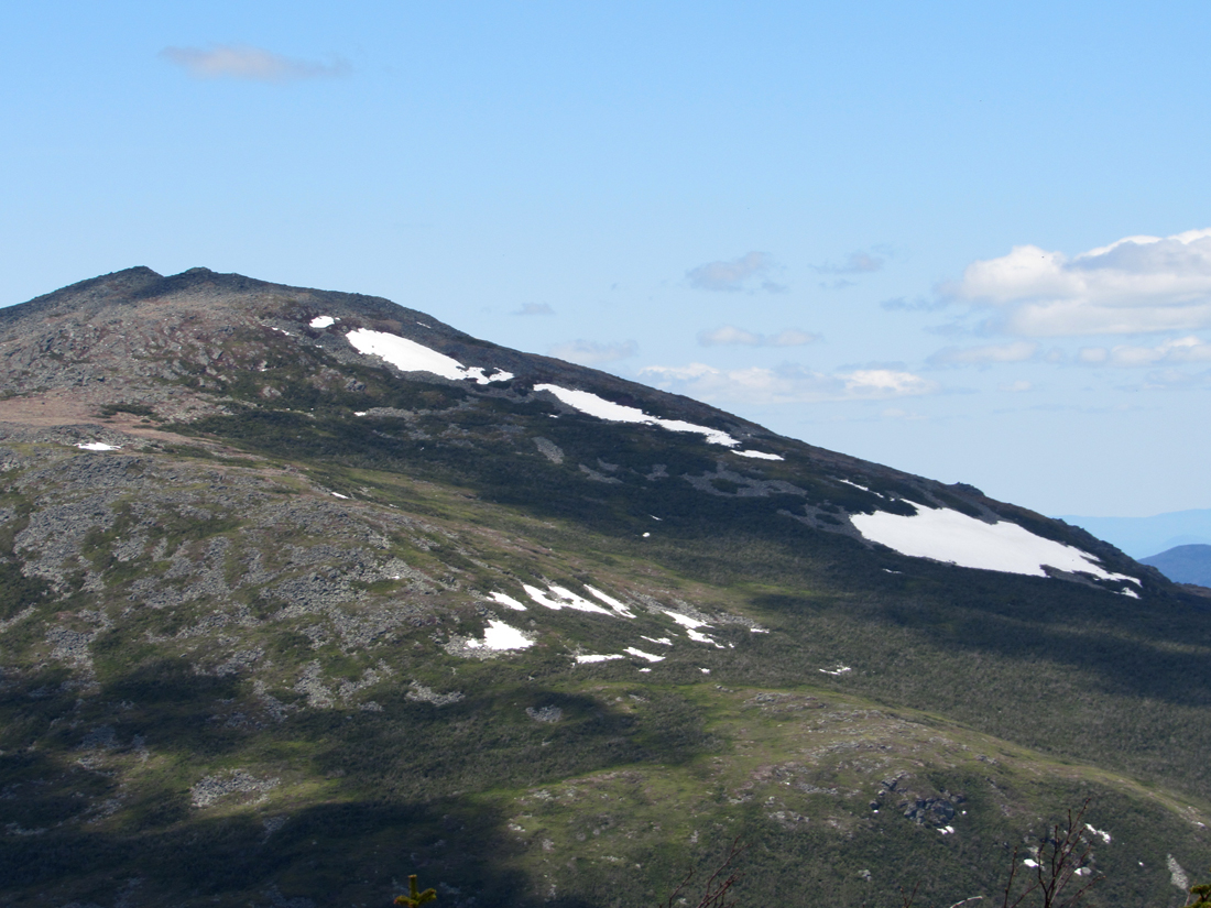
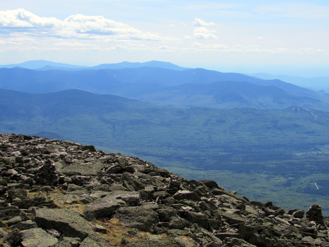
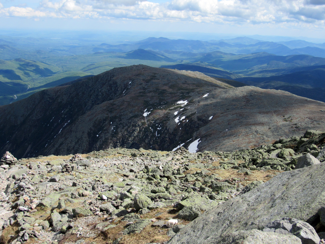
After passing 4000 ft near mile marker 4, we reached treeline and the views across the Great Gulf to the northern Presidentials really opened up. The weather was perfect for a hike up high; there was no wind to speak of, it was neither cold nor hot, and only a few fair-weather clouds floated by. Here I took several photos of Mts Madison, Adams, and Jefferson, and then Patches and I stopped by the side of the road for a food and water break amongst some rocks. The short rest was nice but we still had 3-1/2 miles and over 2,000 ft to go.
About halfway to the mile 5 marker, one of the asphalt trucks stopped next to us, and the driver told me that they were paving the road about a mile ahead. They were only doing short sections at a time, but on the most-recently paved section, I would have to carry Patches; the surface was firm enough for me to walk on but was too hot for Patches' feet. I thanked him and we both continued on our way.
We soon came to an area where the old road surface had been removed and replaced by gravel, We could also see further ahead to where they were now working on the road. At the start of the gravel section, the trucks had to turn around and then back up the rest of the way to the job site in order to dump the asphalt out their backs. We just kept on slogging uphill for another twenty minutes or so until we reached the newly-laid asphalt. Here, another worker reminded me that I would have to carry Patches across the hot pavement, so I picked her up and continued carefully ahead. Luckily, it wasn't very far to the end of the hot surface, no more than a minute or two at most.
Beyond the work area, the road curved to the right around a switchback and we were soon out of sight of the construction. Then, as we were getting close to mile marker 6, we once again met the woman runner who was now on her way back down. I asked whether the wind was stronger and the temperature cooler up higher, but she said that it was about the same. We wished each other a good hike and continued on our way.
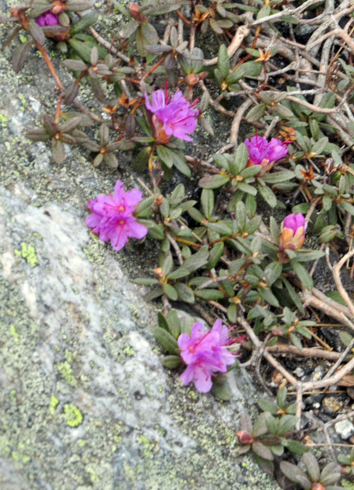
Near the top end of the Huntington Ravine Trail, which I had climbed alone back in 2007, we came across a small patch of Lapland Rosebay growing in a crevice in the rock. This plant is one of the first alpine shrubs to bloom on Mt Washington. Since it was still May, I was lucky to have come across it, though it may have had something to do with the below average snowfall this past winter.
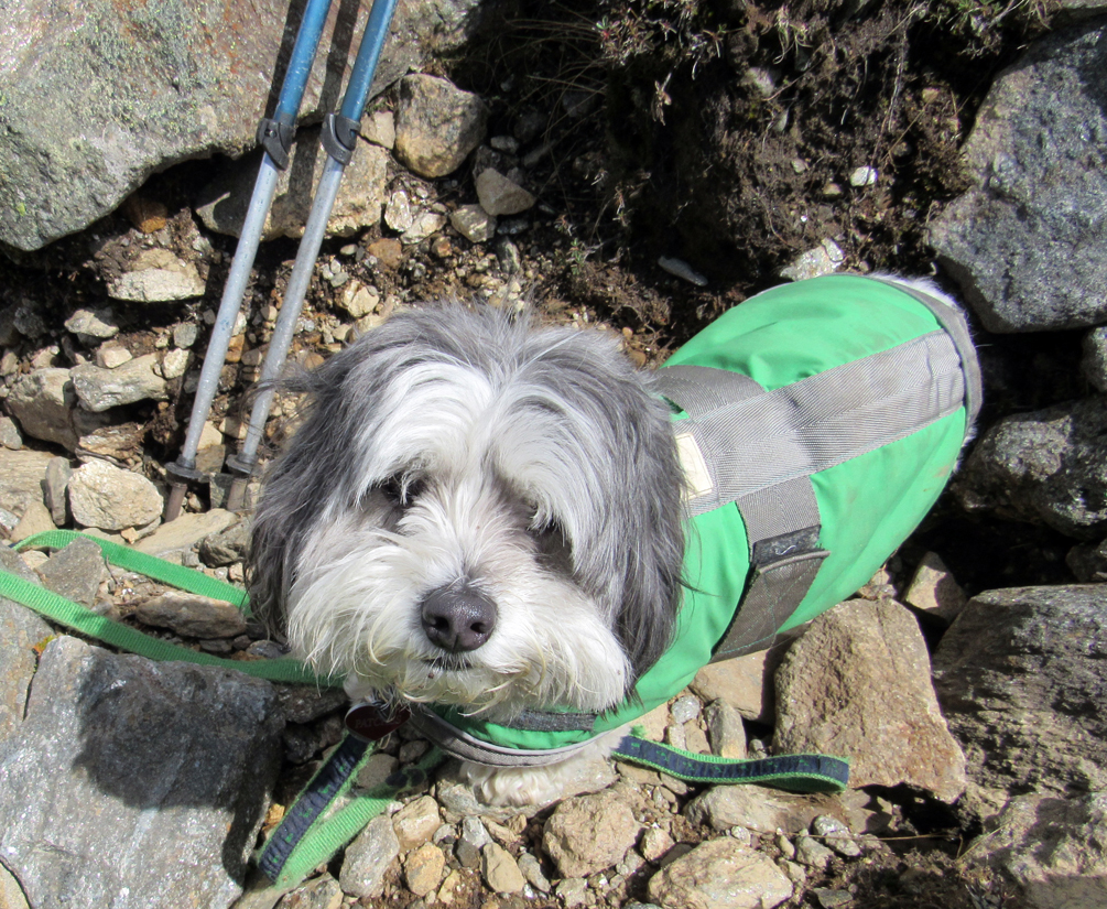
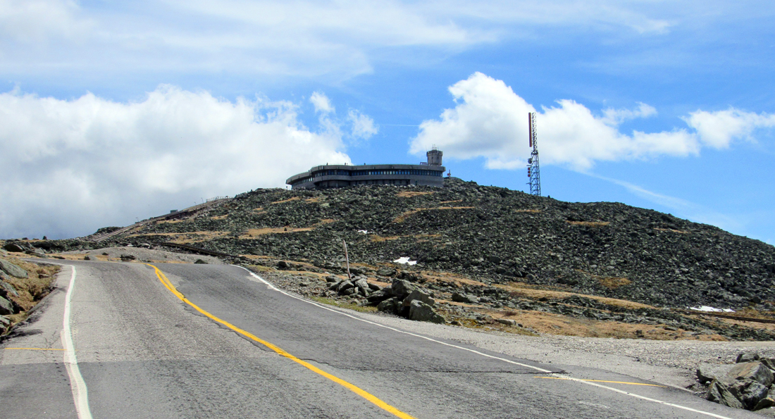
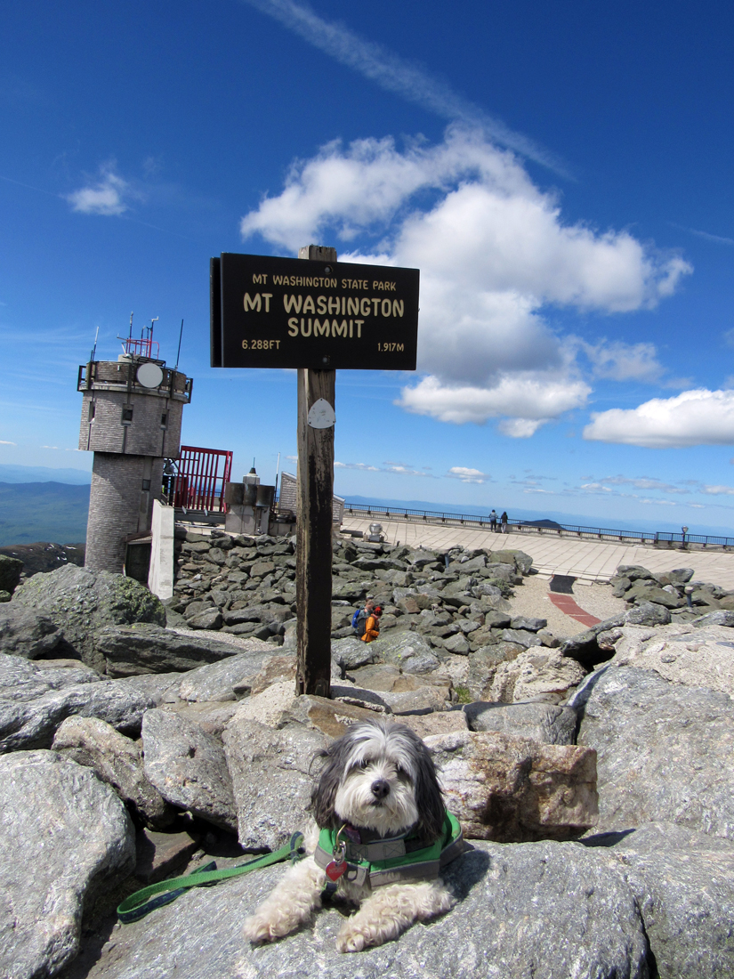
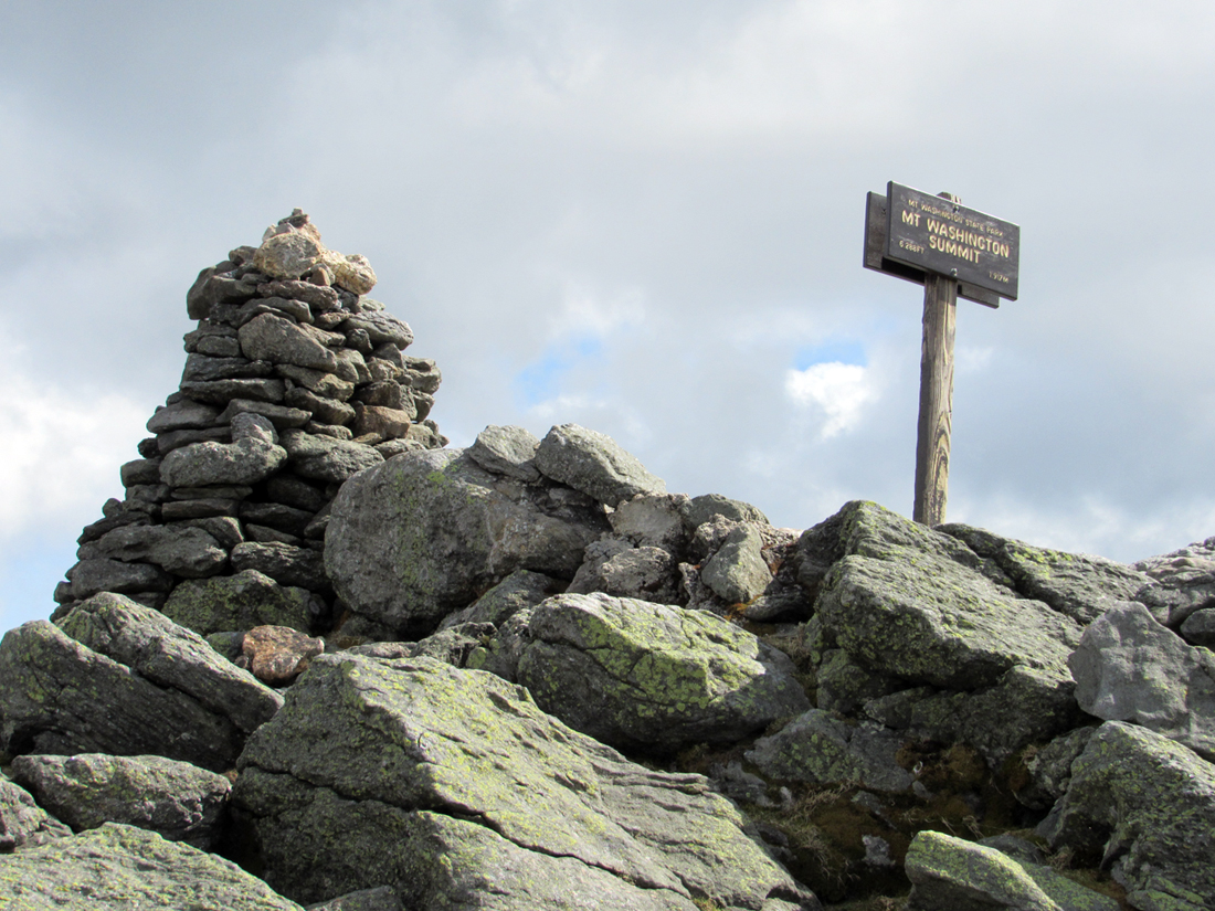
The last mile seemed to go on forever, but just seeing our goal ahead brought on a new burst of energy. Even so, It was almost anticlimactic approaching the highest peak in the northeast via the profane every-day surface of the Auto Rd instead of the usual boulder-strewn trail. Our first act at reaching the top was to get a picture of Patches next to the iconic Mt Washington Summit sign, much as AT thru-hikers do upon ending their long journey on top of Mt Katahdin.
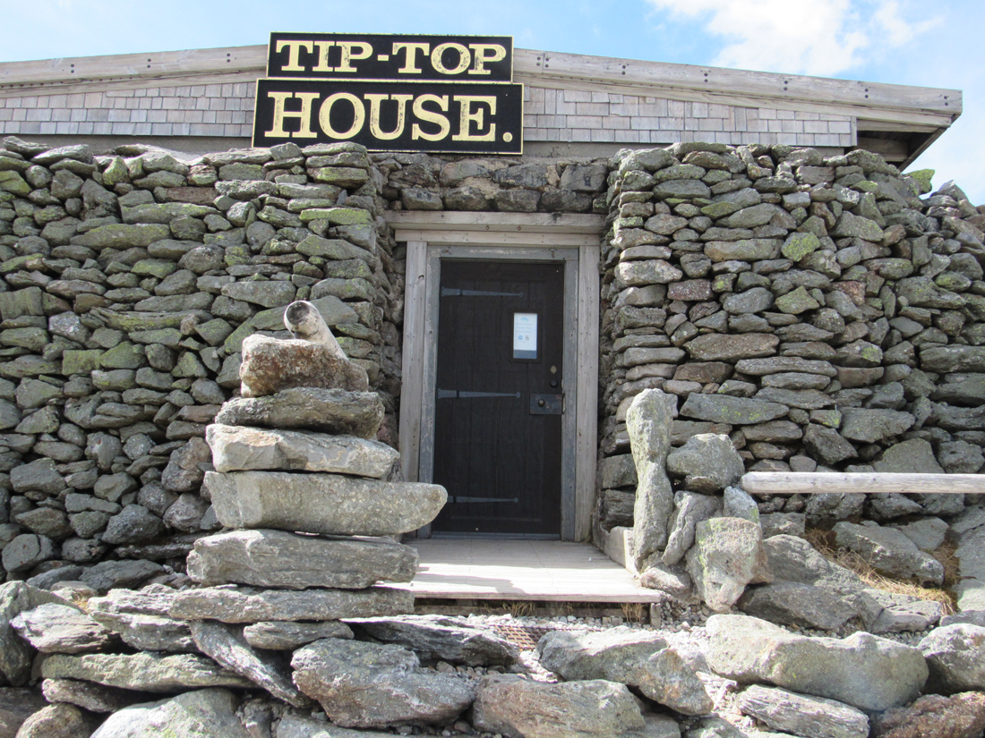
The summit buildings were, of course, closed to the public, but there were a a mix of hikers and cog railway tourists milling about, as well as various summit personnel getting ready for the onslaught of sightseers over the coming Memorial Day weekend. At least two or three people asked me whether Patches had made it up here without any help. I, of course, told them how good of a climber she was and that she was nearly done with the 48 Four Thousand Footers.
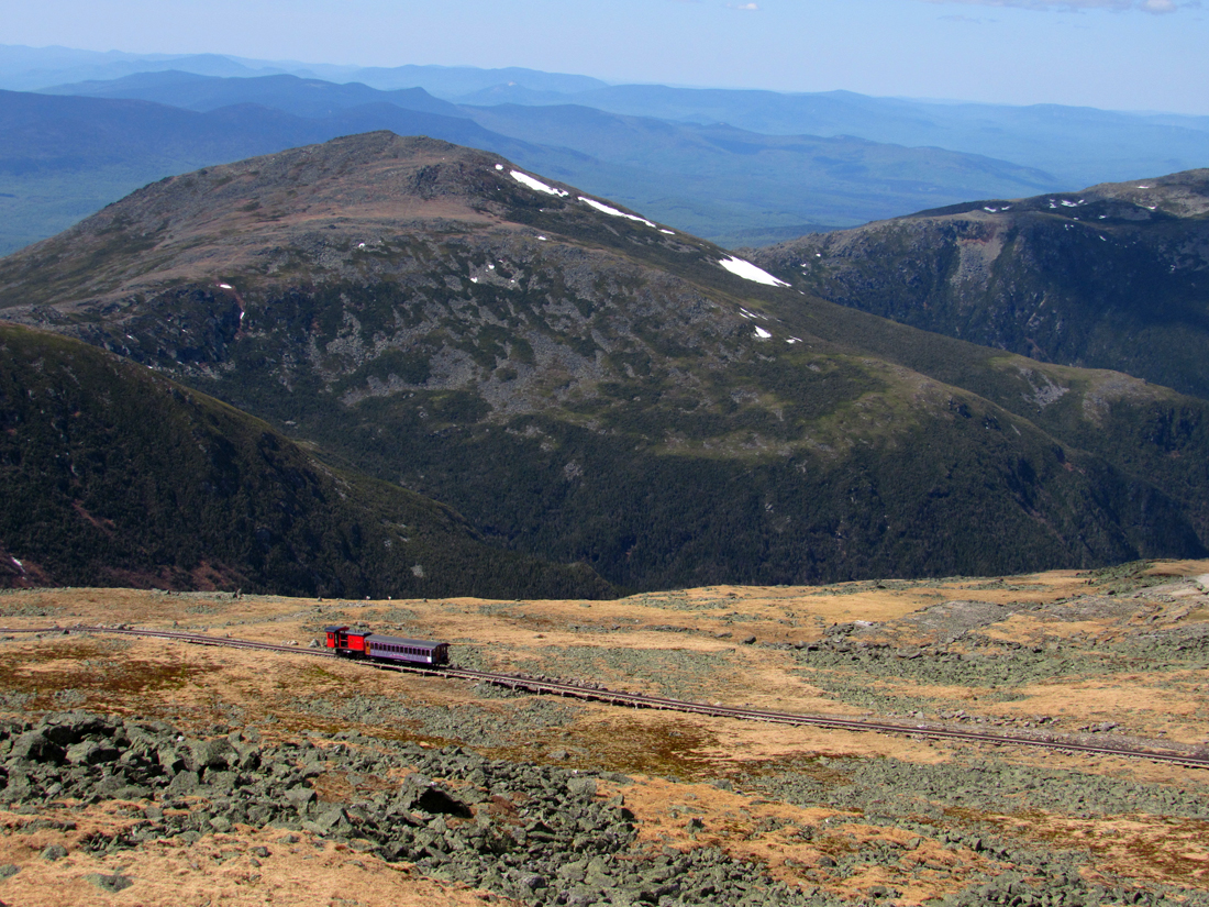
Patches and I sat on a bench for a while snacking on Pringles and a power bar, and then headed up to the observation deck to get a good look at the surrounding vistas of the Northern Presidentials, the Wildcats and Carters, and the ranges to the west. The more distant peaks were wrapped in a a blue-gray haze; there was no chance of spotting the ocean off the coast of Maine or the Green Mountains and Adirondacks in the opposite direction, but it didn't matter. The clarity of nearby Jefferson, Adams, and Madison rising steeply up from the depths of the Great Gulf dominated the northern landscape and more than made up for the lack of those far-off sights.
The weather was so pleasant that it was a shame that we had to leave, but there was still a long walk down ahead of us and a chance that we would be taking down the tent and heading home tonight, so back down we started, expecting a much quicker trip down than coming up. By the time we got below mile marker 4 and were below treeline, I began to realize that the soles of my feet needed some relief; my socks had gotten damp from sweat and each step was prickly and uncomfortable, so we stopped by the side of the road where I could change my socks. It was lucky that I had brought another pair because both of my feet had blisters on the heels, one more so than the other. As I mentioned earlier, the relentless footfalls on pavement eventually catch up to you.
At mile marker 2, I (unfortunately) decided that it might be better to continue down the Auto Road to the bottom instead of taking Old Jackson Road back to the car. I was tired of climbing and wanted to avoid the ups and downs in that trail, and there was always a chance to get a ride back to Pinkham Notch if we were lucky.
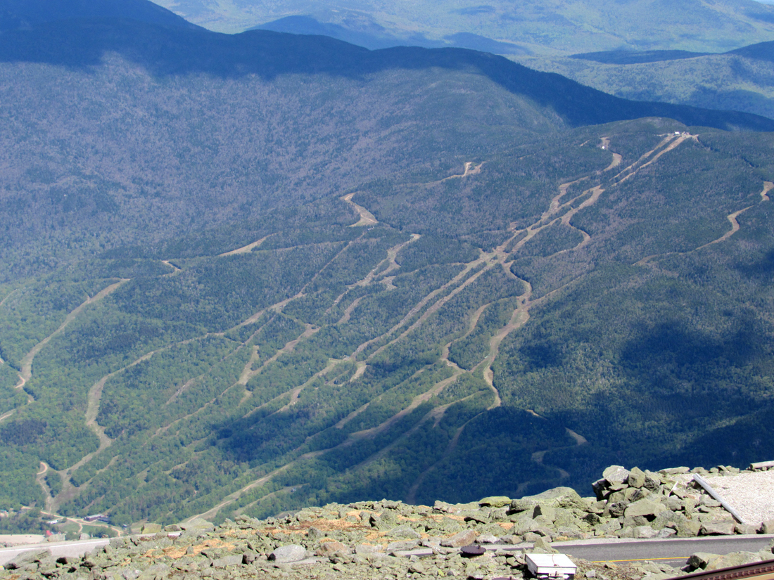
Needless to say, we were not lucky. I had also forgotten that the Auto Road curved back north near the bottom and that Rt 16 was actually over a half-mile longer than Old Jackson Rd. I should have looked at my map before making that decision as not only is Rt 16 longer, but it also involves more than 400 ft of elevation gain. Growing tired and annoyed at the amount of traffic, especially huge semis, constantly speeding by, we took a slight detour via the north access road of Wildcat Mountain Ski Area's parking lot, emerging back out onto Rt 16 close to the AMC Visitor Center and our car.
Back at the campground, we crawled back into the tent. rested for a few minutes, and then started to pack up our things (actually, Patches didn't do any packing. She just wanted to lie down on my sleeping bag and rest). After taking down the tent and carrying everything to the car, I noticed that the car was leaning to the right and its right front tire was hanging slightly over the rock-lined border of the parking spot, which was about two feet above the level of the tent and picnic table. It certainly wasn't like that when we first go out of the car to go into the tent. After stuffing our equipment into the trunk, I started the car and tried to back it up. The tires spun but the car wouldn't budge. I tried a few things to no avail so I decided to call AAA for a tow.
About two hours and several attempted phone calls later, I realized that we weren't going to get out of there that night so I had to unpack the car, set up the tent again, and drag everything back so we could go to bed and wait for the morning. I had planned on stopping at McDonald's in Gorham to get supper - Patches didn't have any extra dog food, and I only had a couple of power bars and a roll left. We split the roll and I gave her a couple of pieces of the power bar (it was blueberry, not chocolate), and we soon fell asleep after our long day.
Day 3
In the morning, I noticed a guy walking around and looking at our car, so I got out the tent to see whether the AAA tow truck had finally arrived. It wasn't AAA, but another camper with a pickup truck who heard the noise of my wheels spinning last night and came to see what was going on. I explained to him about what had happened and how AAA had never showed up. He said that he had a tow strap in his truck, and with the help of one of his friends who had been a tow truck driver, he thought he could pull it back out so I could be on my way. After a discussion about the AAA issue, I decided to let him try. I sat in my car and turned the steering wheel as directed by his friend who stood near the right front wheel to watch how it was clearing the rock. A couple of adjustments to the steering while I was being towed slowly backward, and voila, we were free! Naturally, I thanked both of them profusely.
While this was all going on, the park ranger showed up to ask me to pay for a second night. I explained the whole business about how we hadn't expected to stay another night, but she still asked me to come by the ranger station to pay on my way out. I thought that she could have been more sympathetic and not charge us for last night, but I guess it was amother case of adding insult to injury.
After taking down the tent down (again) and stashing everything back into the trunk, we stopped to pay the bill and then hightailed it out of there, stopping briefly in Gorham to get Patches some dog food for breakfast at Cumberland Farms and me a muffin and hash browns at McDonald's, before hitting the highway for the long trip back. |
Small cascade at a minor brook crossing along Old Jackson Rd. |

|
