|
I had been attempting an ambitious hike
this time,
climbing Mt Carrigain on the Signal Ridge Trail, descending via
the Desolation Trail, and then hiking the entire length of the
Wilderness/Lincoln Woods Trail out to the Kancamagus Highway near
Lincoln. However, the weather had been wet and foggy on Carrigain,
and the steep and slippery Desolation Trail did not seem
particularly inviting.
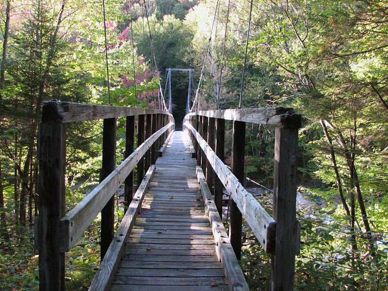
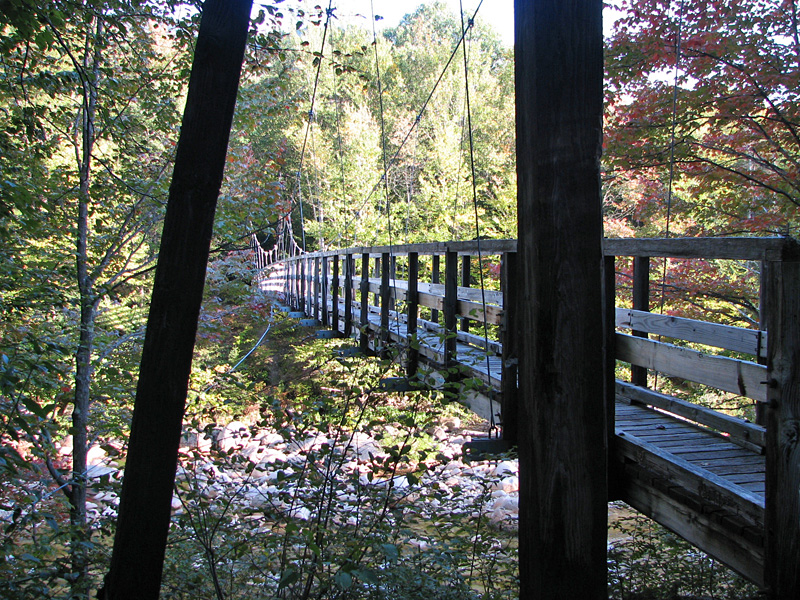
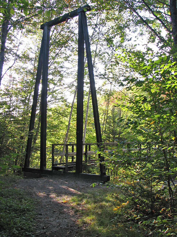
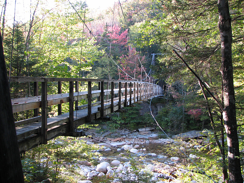
Still, I really wanted to photograph
the suspension bridge over the East Branch of the Pemigewasset, just
beyond the Bondcliff Trail and Black Brook bridge. The Forest
Service was planning on dismantling both the suspension bridge and
the Black Brook bridge a couple of days later, and then closing the
section of the Wilderness Trail between the Bondcliff Trail and the
Cedar Brook Trail. The bridge would soon be dangerous without
repairs, and they had made the decision that wilderness rules
regarding manmade structures meant that they were required to remove
all traces of the bridge rather than build a new one. This decision
caused a lot of controversy among the hiking community, especially
since the Forest Service had recently rebuilt the suspension bridge
in the Great Gulf Wilderness.
At any rate, for me, it was basically either now
or never, so after returning to my car, I drove over to the Lincoln
Woods Trailhead to make the long loop in to the bridge and back again.
Mid-afternoon was an unusually late
start for this enterprise. The suspension bridge was 5.4 miles in
from the trailhead, or 10.8 miles and nearly 1000 ft elevation gain,
and a book time of just over six hours round trip. But I knew I
could make much better time on the flat Lincoln Woods/Wilderness
Trail, and was sure I could trim the time down to four hours round
trip. Still, it didn't hurt to have my headlamp with me.
About halfway to the Black Pond Trail, I
met a guy and his two dogs on their way back from a trip to Owl's
Head. After that, I didn't see anyone until I got back to my car and
drove into Lincoln.
My new Keene hiking boots were giving me
trouble; after wearing them for several hours, I realized that they
were too cramped in the toe area. I stopped near the Franconia Falls
Trail to remove one of my two pair of socks, which eased the
pressure on my big toes a little. Still, I ended up losing a toenail
over those boots, and I returned them to Eastern Mountain Sports a
few days later.
I made good time, passing the Bondcliff
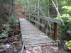
Trail in about 1-3/4 hours. The Black Brook bridge was a bit rickety
but, being low to the ground, was not particularly threatening. The
suspension bridge, however, was definitely beginning to crack and
warp from age, and made cracking and creaking sounds when I walked
across it. The handrails were particularly decayed. A fall from this
bridge would not have been good.
I crossed the suspension bridge and
contemplated returning by the Pemi East Side Trail, but changed my
mind because it wasn't on the itinerary that I had left at home, and
if some unlikely accident occurred, it would not be the first place
they looked for me. I recrossed the bridge and headed back by the
same route.
I made it back to the car in my
estimated four hours, tired and with sore toes, but considered
myself lucky to have been able to take these last pictures of the
bridge on what had, by late afternoon, turned into a beautiful fall
day. |
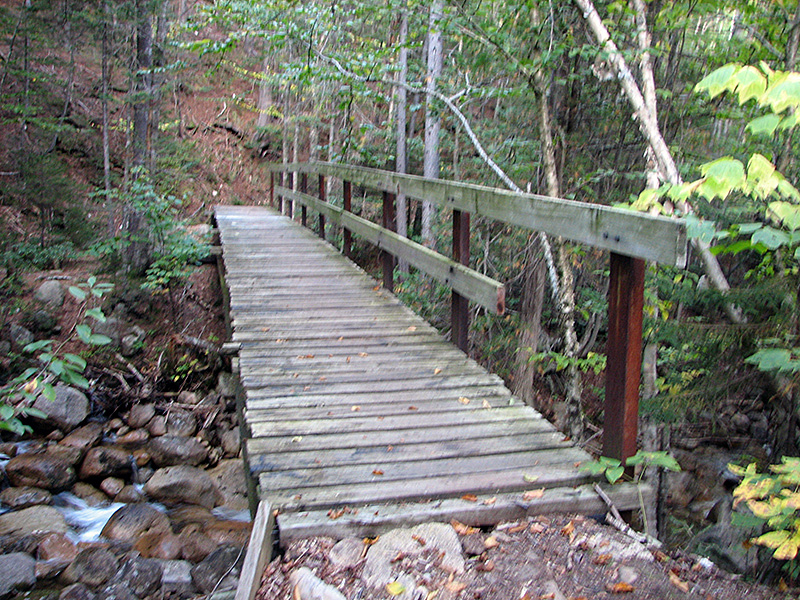
Black Brook
Bridge. The removal of this smaller bridge would not have posed a
significant hazard by itself, but it was aging, and there wasn't
much point in it since the Forest Service was closing the
trail beyond it. |
 |